Tag: cycling

Le Tour de France 2012: Stage 20 Rambouillet and Paris Champs-Élysées

The Tour de France 2012, the world’s premier cycling event kicked off last Saturday with the Prologue in Liège, Belgium and will conclude on July 22 with the traditional ride into Paris and laps up and down the Champs-Élysées. Over the next 22 days the race will take its course briefly along the Northwestern coast of France through  Boulogne-sur-Mer, Abbeville and into Rouen then into the mountains of the Jura, Swiss Alps and the Pyrenees.

Stage 20 Rambouillet, Paris and the Champs-Élysées is our last stage of 2012 Le Tour. Please be sure to click on the images to really enjoy them. Some are really spectacular. We hope everyone has enjoyed the Le Tour and its venues.

Rambouillet

Château de Rambouillet At fifty kilometres from Paris, Rambouillet is the doorway to the Haute Vallée de Chevreuse Regional Nature Park. It is like a glade in the heart of the Rambouillet forest, a forest with nearly 30,000 acres of the most wonderful flora and fauna, dotted with ponds and crossed by many footpaths, cycle tracks and bridleways. Its castle (14th-18th centuries) has seen great lords, kings, emperors and presidents pass through its doors. Francis I died there in 1547, Louis XVI built the Queen’s Dairy in the Park for Marie-Antoinette and many international conferences have been held here. Provincial in its charm and tranquility, Rambouillet, which has managed its development while preserving its natural assets, is francilien also by its economic life. Partnering the town in welcoming this final stage, Yvelines has a very strong policy for the development of a more environmentally friendly transport system, in particular the creation of a network of cycle paths and greenways and with bike lanes spread over about 750 km of its territory.

The Château de Rambouillet, a former medieval fortress, was acquired by Louis XVI of France in 1783 as a private residence because of its ideal situation in the game-rich forest of Rambouillet. It became a bien national during the French Revolution of 1789, and one of the imperial residences of Napoléon I during the First French Empire. At the time of the Bourbon Restoration, the castle became royal residence, and it is there that Charles X signed his abdication on 2 August 1830. Sometimes neglected at times of political unrest, the château de Rambouillet became the official summer residence of the French President of the Republic after President Félix Faure chose it as summer residence for himself and his family in 1896; Rambouillet thus became the official summer residence of the Presidents of the Third Republic and has retained its position ever since.

Paris and  the Champs Élysées

Paris is one of those rare cities that just about everywhere you are there is history,  it has been well preserved and you can feel it. It is truly one of the most beautiful cites in the world. I say that with some prejudice, it is my main home.

Paris at Night Paris loves the Tour de France and is delighted to welcome once again the arrival of “La Grande Boucle” to the most beautiful avenue in the world. Each year, the last act of the Tour on the Champs Élysées brings delight to Parisians and the numerous tourists from around the world who have come to encourage and applaud the Yellow Jersey and the entire peloton. This sporting celebration is also an opportunity to recall the commitment of the City of Paris to promote cycling. For ten years, 700 kilometers of bicycle lanes have been created, dedicated pathways are multiplying and quayside roads are now reserved on Sundays and public holidays for walking, cycling and sustainable transport. In addition, five years after its launch, Vélib bicycle rental system, has allowed Parisians and the inhabitants of thirty municipalities on the outskirts to take over a hundred million journeys. This popular transport service is actively involved in the fight against greenhouse gas emissions and the goal is to try to reduce them by 25% by 2020. Vélib is proof, if any were needed, of the enthusiasm aroused by “the little queen” in Paris.

Avenue des Champs-Élysées

Avenue des Champs-Élysées With its cinemas, cafés, luxury specialty shops and clipped horse-chestnut trees, the Avenue des Champs-Élysées is one of the most famous streets and one of the most expensive strips of real estate in the world. Several French monuments are also on the street, including the Arc de Triomphe and the Place de la Concorde. The name is French for Elysian Fields, the place of the blessed dead in Greek mythology. The Avenue des Champs-Élysées is known as “The most beautiful avenue in the world”, La plus belle avenue du monde in French.

The Champs-Élysées was originally fields and market gardens, until 1616, when Marie de Medici decided to extend the axis of the Tuileries Garden with an avenue of trees. As late as 1716, Guillaume Delisle’s map of Paris shows that a short stretch of roads and fields and market garden plots still separated the grand axe of the Tuileries gardens from the planted “Avenue des Thuilleries,” which was punctuated by a circular basin where the Rond-point des Champs-Élysées stands today; already it was planted with some avenues of trees to the Seine river through woods and fields. In 1724, the Tuileries Garden axis and the avenue were connected and extended, leading beyond the Place de l’Étoile; the “Elysian Fields” were open parkland flanking it, soon filled in with bosquets of trees formally planted in straight rank and file. To the east, the unloved and neglected “Vieux Louvre” (as it is called on the maps), still hemmed in by buildings, was not part of the axis. In a map of 1724, the Grande Avenue des Champs-Elisée stretches west from a newly-cleared Place du Pont Tournant soon to be renamed for Louis XV and now the Place de la Concorde. By the late 18th century, the Champs-Élysées had become a fashionable avenue; the bosquet plantings on either side had thickened enough to be given formal rectangular glades (cabinets de verdure). The gardens of houses built along the Faubourg Saint-Honoré backed onto the formal bosquets. The grandest of them was the Élysée Palace. A semicircle of house-fronts now defined the north side of the Rond-Point. The avenue from the Rond-Point to the Étoile was built up during the Empire. The Champs-Élysées itself became city property in 1828, and footpaths, fountains, and gas lighting were added. Over the years, the avenue has undergone numerous transitions, most recently in 1994, when the sidewalks were widened.

Arc de Triomphe The Arc de Triomphe (Arc de Triomphe de l’Étoile) is one of the most famous monuments in Paris. It stands in the centre of the Place Charles de Gaulle (originally named Place de l’Étoile), at the western end of the Champs-Élysées. There is a smaller arch, the Arc de Triomphe du Carrousel, which stands west of the Louvre. The Arc de Triomphe (in English: “Triumphal Arch”) honours those who fought and died for France in the French Revolutionary and the Napoleonic Wars, with the names of all French victories and generals inscribed on its inner and outer surfaces. Beneath its vault lies the Tomb of the Unknown Soldier from World War I.

The Arc de Triomphe is the linchpin of the historic axis (Axe historique) – a sequence of monuments and grand thoroughfares on a route which goes from the courtyard of the Louvre, to the Grande Arche de la Défense. The monument was designed by Jean Chalgrin in 1806, and its iconographic program pitted heroically nude French youths against bearded Germanic warriors in chain mail. It set the tone for public monuments, with triumphant patriotic messages.

The monument stands 50 metres (164 ft) in height, 45 m (148 ft) wide and 22 m (72 ft) deep. The large vault is 29.19 m (95.8 ft) high and 14.62 m (48.0 ft) wide. The small vault is 18.68 m (61.3 ft) high and 8.44 m (27.7 ft) wide. It was the largest triumphal arch in existence until the construction of the Arch of Triumph in Pyongyang, in 1982. Its design was inspired by the Roman Arch of Titus. The Arc de Triomphe is so colossal that three weeks after the Paris victory parade in 1919, (marking the end of hostilities in World War I), Charles Godefroy flew his Nieuport biplane through it, with the event captured on newsreel.

Place de la Concorde The Place de la Concorde is one of the major public squares in Paris, France. Measuring 8.64 hectares (21.3 acres) in area, it is the largest square in the French capital. It is located in the city’s eighth arrondissement, at the eastern end of the Champs-Élysées.

The Place was designed by Ange-Jacques Gabriel in 1755 as a moat-skirted octagon between the Champs-Élysées to the west and the Tuileries Gardens to the east. Decorated with statues and fountains, the area was named Place Louis XV to honor the king at that time. The square showcased an equestrian statue of the king, which had been commissioned in 1748 by the city of Paris, sculpted mostly by Edmé Bouchardon, and completed by Jean-Baptiste Pigalle after the death of Bouchardon. The stone is made of a combination of lime and blue stone. The chemical compounds have let it survive for so long under acid rain.

At the north end, two magnificent identical stone buildings were constructed. Separated by the rue Royale, these structures remain among the best examples of Louis XV style architecture. Initially, the eastern building served as the French Naval Ministry. Shortly after its construction, the western building became the opulent home of the Duc d’Aumont. It was later purchased by the Comte de Crillon, whose family resided there until 1907. The famous luxury Hôtel de Crillon, which currently occupies the building, took its name from its previous owners; it was the headquarters of the German High Command during World War II.

During the French Revolution the statue of Louis XV of France was torn down and the area renamed “Place de la Révolution”. The new revolutionary government erected the guillotine in the square, and it was here that King Louis XVI was executed on 21 January 1793. Other important figures guillotined on the site, often in front of cheering crowds, were Queen Marie Antoinette, Princess Élisabeth of France, Charlotte Corday, Madame du Barry, Georges Danton, Camille Desmoulins, Antoine Lavoisier, Maximilien Robespierre, Louis de Saint-Just and Olympe de Gouge.

The guillotine was most active during the “Reign of Terror”, in the summer of 1794, when in a single month more than 1,300 people were executed. A year later, when the revolution was taking a more moderate course, the guillotine was removed from the square.

The square was then renamed Place de la Concorde under the Directory as a symbolic gesture of reconciliation after the turmoil of the French Revolution. It underwent a series of name changes in the nineteenth century, but the city eventually settled on Place de la Concorde.

The center of the Place is occupied by a giant Egyptian obelisk decorated with hieroglyphics exalting the reign of the pharaoh Ramses II. It is one of two the Egyptian government gave to the French in the nineteenth century. The other one stayed in Egypt, too difficult and heavy to move to France with the technology at that time. In the 1990s, President François Mitterrand gave the second obelisk back to the Egyptians.

The obelisk once marked the entrance to the Luxor Temple. The Ottoman viceroy of Egypt, Mehmet Ali, offered the 3,300-year-old Luxor Obelisk to France in 1829. It arrived in Paris on 21 December 1833. Three years later, on 25 October 1836, King Louis Philippe had it placed in the center of Place de la Concorde, where a guillotine used to stand during the Revolution.

Le Tour de France 2012: Stage 18; Bonneval and Chartres

The Tour de France 2012, the world’s premier cycling event kicked off last Saturday with the Prologue in Liège, Belgium and will conclude on July 22 with the traditional ride into Paris and laps up and down the Champs-Élysées. Over the next 22 days the race will take its course briefly along the Northwestern coast of France through  Boulogne-sur-Mer, Abbeville and into Rouen then into the mountains of the Jura, Swiss Alps and the Pyrenees.

We will be Live Blogging Le Tour 2012 every morning at The Stars Hollow Gazette starting at 7:30 AM EDT. Come join us for a morning chat, cheer the riders and watch some of the most beautiful and historic countryside in Europe.

Stage 18 Towns: Bonneval and Chartres

Bonneval

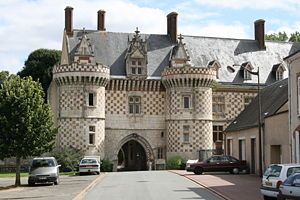
Bonneval Abbey Referred to as the Little Venice of Beauce for its green environment and surrounding ditches, Bonneval is a perfect town for resting your body and mind. On one of the Saint-

Jacques de Compostela routes, this pretty green resort has many vestiges of the Middle Ages: a former Benedictine abbey founded in 857, fortifications from the twelfth and thirteenth centuries, the gate from the fifteenth century. Main town in the Canton and seat of the Community of Bonnevalais Communes, Bonneval is located one hour from Paris. Close to the A10 and A11, it is served by the RN 10 and the SNCF line Paris-Tours. Bonneval has many schools (from nursery to college), shops and businesses, a children’s centre, squares, new housing and a rich network of associations. Soon, a new swimming pool will complete the lineup of facilities necessary for the lifestyle and comfort of its residents while preserving the calm and tranquility to the delight of tourists who enjoy the unique charms of a ride on an electric boat on the Loir river. What could be better than silently sailing down a river and taking in the unspoiled flora and fauna …

Chartres

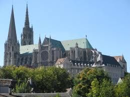
Chartres Cathedral Built on the site of an ancient Gallic city, Chartres owes the origin of its name to the Carnutes who occupied the region at the time. Later, during the Middle Ages it underwent major economic activity which developed especially on the banks of the Eure River, which crosses the city. Today, Chartres owes its international fame to the Notre Dame Cathedral, a masterpiece of Gothic art, nicknamed the Acropolis of France by Auguste Rodin. Given UNESCO World Heritage status it is famous for its stained glass windows and their unique blue colour, the “Chartres blue”. But, throughout the medieval streets of the old town, you can also discover other architectural treasures that are lit up every evening during the summer. Tied to its history but resolutely looking towards the future, Chartres, thanks to its proximity to the capital, is home to a quality cosmetics industry with perfumers Guerlain and Paco Rabanne. It also welcomed the 21st century by acquiring ultramodern sports and culture facilities.

Click on images to enlarge

Le Tour de France 2012: Stage 17

The Tour de France 2012, the world’s premier cycling event kicked off last Saturday with the Prologue in Liège, Belgium and will conclude on July 22 with the traditional ride into Paris and laps up and down the Champs-Élysées. Over the next 22 days the race will take its course briefly along the Northwestern coast of France through  Boulogne-sur-Mer, Abbeville and into Rouen then into the mountains of the Jura, Swiss Alps and the Pyrenees.

We will be Live Blogging Le Tour 2012 every morning at The Stars Hollow Gazette starting at 7:30 AM EDT. Come join us for a morning chat, cheer the riders and watch some of the most beautiful and historic countryside in Europe.

Bagnères-de-Luchon and Peyragudes

Bagnères-de-Luchon

Again Le Tour starts where it finished the day before, Bagnères-de-Luchon.

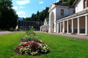
Bagnères-de-LuchonThe stage departed from the main artery of the city, les Allées Etigny. This avenue, characterized by its row of architecturally varied buildings is opposite the Thermal Springs for which the city has been known since Roman times. Busiest station of the Haute-Garonne and the Midi-Pyrénées, Bagnères-de-Luchon, that joined the European Association of Spa Towns in 2011, originally specialised in the treatment of respiratory tracts and rheumatology. It added lombago, fibromyalgia and cures for smoking cessation. Its vaporarium, huge natural steam room, is unique in Europe. It consists of a network of galleries built underground in the late 60s and renovated in 2010. From the depths of the mountain, the water filters through the rock walls giving out a soft vapour whose heat varies between 38 and 40 degrees. In addition to their therapeutic properties, the sources have geothermal potential which, in the near future, will be used to heat the spa facility and supply a heating network.
Peyragudes

A new mountain and a new finish, Peyragudes is a ski resort in the French Pyrenees, situated in the departments of Hautes-Pyrénées and Haute-Garonne, in the Midi-Pyrénées.

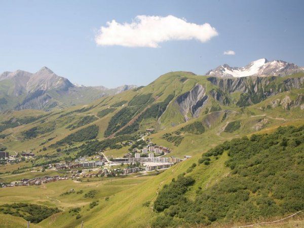
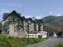
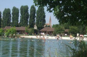
Peyragudes Ski SationAt the heart of the Pyrenees, Peyragudes is a mountain resort that offers 60 kilometres of ski pistes in the winter and a variety of mountain activities in summer. Created in 1988 following the merger of two ski resorts, the resort of Agudes and the resort of Peyresourde, Peyragudes straddles two departments, the Haute-Garonne on the Agudes side and the Hautes-Pyrenees on the Peyresourde side. In summer, many mountain activities are available such as paragliding, hiking, mountain scooters, mountain climbing and fishing while many cyclists frequent the resort to climb the surrounding legendary mountain passes like the Col de Peyresourde or the Aspin. In winter, Peyragudes is a modern ski resort with more than 1500 hectares with magnificent scenery on the highest peaks in the Pyrenees. The resort also offers many after-ski activities: discover the world of the piste-basher, have an introduction to driving sled dogs, try nights in an igloo but also relax at Balnéa, the natural spring spa located fifteen minutes away on the banks of Lake Genos-Loudenvielle.
Le Tour de France 2012: Stage 16

The Tour de France 2012, the world’s premier cycling event kicked off last Saturday with the Prologue in Liège, Belgium and will conclude on July 22 with the traditional ride into Paris and laps up and down the Champs-Élysées. Over the next 22 days the race will take its course briefly along the Northwestern coast of France through  Boulogne-sur-Mer, Abbeville and into Rouen then into the mountains of the Jura, Swiss Alps and the Pyrenees.

We will be Live Blogging Le Tour 2012 every morning at The Stars Hollow Gazette starting at 7:30 AM EDT. Come join us for a morning chat, cheer the riders and watch some of the most beautiful and historic countryside in Europe.

The Towns of Stage 16 Pau and Bagnères-de-Luchon

Pau

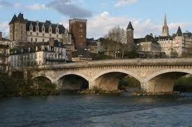
Pau, Fr Castle Henri IVPau was the finish of Stage 15 on Monday and the riders spent the day there resting for the Stage 16 start from the same town.

In November 2011 Pau was given the title of Town of Art and History, which means it joins a national network of currently more than 170 towns on mainland France and Corsica with the same title. This prestigious honour recognises the efforts of the municipality in protecting the heritage of the city and developing its town projects. This approach of study, conservation, development and support towards architectural quality and to the quality of life has been on the go since 2009. The label Town of Art and History gives more coherance and legibility to cultural policy, to development and gives a sense of heritage to the people of Pau, whilst also reinforcing links between the residents and their town. The label is a dynamic expression of this renewed cultural policy and heritage. It is a real tool for the tourist industry and shines a light on the area, whether for Pau Porte des Pyrénées or for the surrounding towns with common themes such as holiday resorts, pyreneeism tourism or even the bearnaise identity.

Bagnères-de-Luchon

Bagnères-de-LuchonBagnères-de-Luchon, also referred to as Luchon, is a spa town and a commune in the Haute-Garonne department in southwestern France.

Bagnères-de-Luchon is celebrated for its thermal springs. The springs, which number forty eight, vary in composition, but are chiefly impregnated with sodium sulfate, and range in temperature from 62 to 150 Fahrenheit. The discovery of numerous Roman remains attests the antiquity of the baths, which are identified with the Onesiorum Thermae of Strabo. Their revival in modern times dates from the latter half of the 18th century, and was due to Antoine Mégret d’Étigny, intendant of Auch.

Within the town today (2006), a more modern entrance to the baths sits alongside the older buildings. The bathing experience consists of repeated spells within a hot, sulphurous atmosphere in caves that run approximately 100 metres inside the Superbagnères mountain, and in a cool swimming pool within the entrance building. It was these sulphur springs that led to a twinning of the settlement with Harrogate in 1952.

Known since 1834 as “the Queen of the Pyrenees” by Vincent de Chausenque in his work Les Pyrénées ou voyages pédestres (The Pyrenees on foot), Bagneres de Luchon, which is the most characteristic mountain town in the Pyrenees, offers the perfect setting for mountain and outdoor activities but also for relaxation and fun for all. Thanks to its natural environment it makes it possible to practise many sporting activities throughout the summer and winter: hiking, mountain biking, trout fishing while canyoning, rafting and paragliding await all thrill seekers. Linked to the Superbagnères resort in eight minutes by cable car, Bagnères de Luchon does not however, rely soley on its strengths in the field of sport. In cultural terms, it offers throughout the year about six hundred events including two flagship events, the International TV Film Festival and the Flower Festival. The finishing line of the 16th stage will be located near to the Villa Julia where French writer Edmond Rostand spent twenty-two summers of his youth and wrote Les Musardies.

Le Tour de France 2012: Stage 15

The Tour de France 2012, the world’s premier cycling event kicked off last Saturday with the Prologue in Liège, Belgium and will conclude on July 22 with the traditional ride into Paris and laps up and down the Champs-Élysées. Over the next 22 days the race will take its course briefly along the Northwestern coast of France through  Boulogne-sur-Mer, Abbeville and into Rouen then into the mountains of the Jura, Swiss Alps and the Pyrenees.

We will be Live Blogging Le Tour 2012 every morning at The Stars Hollow Gazette starting at 7:30 AM EDT. Come join us for a morning chat, cheer the riders and watch some of the most beautiful and historic countryside in Europe.

Stage 15 Towns: Samatan and Pau

Samatan

Samatan is a commune in the Gers department in southwestern France. This is the first time Samatan has been a stage town for Le Tour.

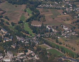
Samatn, Fr From its many hills, Samatan, at the gates of Gascony and Toulouse, offers a great view on the Pyrenees with the pikes of Arbizon and Midi de Bigorre in the background. Its harmonious landscape, green and relaxed, is scattered with small woods and isolated farms in the huge check-board of the fields. This is why Samatan logically turned to green tourism with an emphasis on gastronomy and trekking.

The town has been equipped since the 1980S by a holiday village on the banks of a now renowned lake. It comprises a hotel nd adining rooms with a panoramic view over the lake. 2012 is an important year for the holiday centre as the lodgings will be entirely refurbished while the outside greens have been renovated in the respect of environment. Among the novelties, a spa has been added to the many activities on offer while access for the disabled has been improved.

Pau

 Pua is a commune on the northern edge of the Pyrenees, capital of the Pyrénées-Atlantiques département in France. The site was fortified in the 11th century to control the ford across the Gave de Pau. It was built on the north bank, equidistant from Lescar, seat of the bishops, and from Morlaàs, and became the seat of the viscounts of Béarn. Pau was made capital of Béarn in 1464. During the early 16th century, the Château de Pau was made more habitable by Gaston III, count of Foix and became the residence of the kings of Navarre, who were also viscounts of Béarn.

In 1188, Gaston VI assembled his cour majour there, predecessor of the conseil souverain and roughly equivalent to the House of Lords (but predating it). Gaston VII added a third tower in the 13th century. Gaston Fébus (Gaston III of Foix and Gaston X of Béarn) added a brick donjon (keep).

Pau was birthplace of Henry IV of France. His mother, Jeanne d’Albret, crossed into France to ensure her son would be born there. The baby’s lips were moistened with the local Jurançon wine and rubbed with garlic shortly after birth. When Henry IV left Pau to become King of France, he remarked to local notables that he was not giving Béarn to France, but giving France to Béarn.

Napoleon III refurbished the château and Pau adding streets of Belle Époque architecture, before the fashion transferred to Biarritz. Pau is still a centre for winter sports and equestrian events, with a steeplechase. King Charles XIV of Sweden, the first royal Bernadotte, was also born in Pau.

Following the assassination of Abraham Lincoln, Mary Todd Lincoln stayed in Pau in the late 1870s, toward the end of her life.

Pau Porte des Pyrénées is a territory of 250,000 men and women with a strong sense of common identity based on peace, sharing and passion. It is a natural outdoors sports destination with the Eaux-Vives Stadium, a golf course, trails for walking and rambling… Nature is everywhere in the town, in its numerous parks and gardens or its plots of land maintained by the sheep. It is also a cultural destination with the Chateau de Pau, its light show and outdoor nightime spectacles in its gardens.  Royal land, the city was the birthplace of Henri IV and Jean-Baptiste Bernadotte who became King of Sweden. It is also the land of good cheer with many homegrown produce: the Jurancon wines, la poule au pot, foie gras, sheeps’ milk cheese. Finally Pau makes the most of an innovative global economy: geosciences, food processing, aeronautics, horse breeding and Pau Broadband Country, the first high speed network in France. Pau has everything on offer to tempt you to stay either for a day, a weekend or your whole life so you can adopt brand Pau Porte des Pyrénées!

The bikers took the today off in the city of Pau. Stage 16 tomorrow will start in Pau  

Le Tour de France 2012: Stage 14

The Tour de France 2012, the world’s premier cycling event kicked off last Saturday with the Prologue in Liège, Belgium and will conclude on July 22 with the traditional ride into Paris and laps up and down the Champs-Élysées. Over the next 22 days the race will take its course briefly along the Northwestern coast of France through  Boulogne-sur-Mer, Abbeville and into Rouen then into the mountains of the Jura, Swiss Alps and the Pyrenees.

We will be Live Blogging Le Tour 2012 every morning at The Stars Hollow Gazette starting at 7:30 AM EDT. Come join us for a morning chat, cheer the riders and watch some of the most beautiful and historic countryside in Europe.

Towns of Stage 14: Limoux and Foix

Limoux

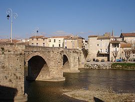
Limoux Limoux is a commune and subprefecture in the Aude department, a part of the ancient Languedoc province and the present-day Languedoc-Roussillon region in southern France.

After being developed around its church, the city rapidly developed thanks to its linen and leather industry. Today, Limoux is renowned for its blanquette (sparkling wine), its Toques et Clochers Festival, its carnival, its museums and its gastronomy.

– la blanquette – it is the oldest sparkling wine in the world. Discovered in 1531 its method of wine production was subsequently applied to champagne by Dom Perignon. It makes up the main economy of the town and of the region. You can also include the Anne de Joyeuse cave that produces quality AOC wines.

– Toques et Clochers – this wine auction held in Spring takes place with the aim of raising money for the restauration of the ancient belltowers (clochers). It is followed by a meal prepared by a top chef (Toque).

– the carnival – every winter it lasts nearly three months. It is the longest carnival in the world. Festivities begin 12 weeks before the religious festival of Palm Sunday.

– the museums – the Petiet Museum is dedicated to paintings, there are also museums celebrating the piano, automata, printing and plants at La Bouichère.

Foix

Château de Foix

Foix is a commune, the capital of the Ariège department in southwestern France. It is the least populous administrative center of a department in all of France. The town of Foix probably owes its origin to an oratory founded by Charlemagne, which afterwards became the Abbey of Saint Volusianus in 849.

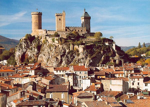
Right in the heart of the Ariège, at the foot of the Pyrenees, Foix, symbolised by its three towers of its Château Comtal, combines the quality of life of an average town with the advantages of its immediate proximity to a great metropolis, Toulouse, but also with the Pyrenees, Spain and Andorra. Undoubtedly the emblematic monument of the city, the Castle (10th – 15th centuries) stands majestically on its rock and was home to the Counts of Foix, including the brilliant Gaston Febus (1343-1391). A Tour stage town and popular with tourists, Foix combines the authenticity of its ancient medieval centre with the diversity of its businesses and the quality of its beautiful natural environment. This unspoiled environment is perfect for so many sporting activities and outdoor leisure pursuits: cycling and mountainbiking, walking or horseriding, rafting in calm or choppy waters or even paragliding down the valley. Foix is in a privileged spot for discovering the treasures of the Ariege department: middle age castles, Cathar citadels, roman abbeys, prehistoric caves.. or quite simply sublime natural locations.  

Le Tour de France 2012: Stage 13

The Tour de France 2012, the world’s premier cycling event kicked off last Saturday with the Prologue in Liège, Belgium and will conclude on July 22 with the traditional ride into Paris and laps up and down the Champs-Élysées. Over the next 22 days the race will take its course briefly along the Northwestern coast of France through  Boulogne-sur-Mer, Abbeville and into Rouen then into the mountains of the Jura, Swiss Alps and the Pyrenees.

We will be Live Blogging Le Tour 2012 every morning at The Stars Hollow Gazette starting at 7:30 AM EDT. Come join us for a morning chat, cheer the riders and watch some of the most beautiful and historic countryside in Europe.

Saint-Paul-Trois-Châteaux – Le Cap d’Agde 217 km

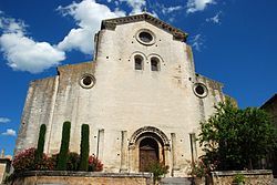
Saint-Paul-Trois-Châteaux Cathedral is a commune in the Drôme department in southeastern France. The name of the city comes from the Gaul tribe of the Tricastini. Local historians incorrectly concluded that the name was derived from the Latin “Tricastinorum”, meaning three castles.

Saint-Paul-Trois-Châteaux is a charming village in the Drôme Provençale, which nestles among vineyards, truffle oaks and fields of lavender, and manages to combine heritage, the land, authenticity and conviviality. Beneath it, the village’s former inhabitants have left behind a number of relics from the prehistoric age, from antiquity and the middle Ages. The mediaeval cathedral, a remarkable example of Roman architecture, is emblematic of the town, sitting majestically in the centre of the village. Inside the city walls, you will discover a host of attractions: mansions, charming little squares adorned with fountains and outdoor cafes. Saint-Paul-Trois-Châteaux is also a gastronomic delight, best known for its truffles, providing 60 per cent of France’s truffles to the market, as well as its wine (AOC wines from Grignan-les-Adhémar) and its many great restaurants. The influence of the village also goes beyond its walls – it’s also known for its children’s book festival, its soul jazz festival, its classical music festival – Les Musicales en Tricastin – and a film festival.

Le Cap d’Agde

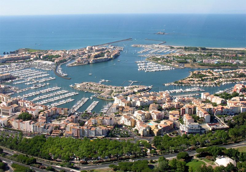
Le Cap d'Agde Cap d’Agde is the seaside resort of the town of Agde, France, on the Mediterranean sea in the département of Hérault, within the région of Languedoc-Roussillon.  Cap d’Agde is one of the largest leisure ports on the French Mediterranean. Development as a tourist resort started in the 1970s before which time the only buildings at the Cap were small houses typically used for weekends by local people.

Set up at the beginning of the 1970s, the Cap d’Agde resort has become, in the space of 40 years, a leading example of a seaside holiday resort with today nearly 175,000 overnight stays. Created by the Interministerial Mission for Territory Management, headed by Pierre Racine, designed by architect Jean Le Couteur, in 2010 it saw its Port Saint-Martin district named Heritage of the 20th Century. Le Cap d’Agde is the emblematic resort of the town of Agde, founded 2,600 years ago by the Greeks of Phocee. A stategic place due to its location in the Gulf of Lion, Agde is situated between the borders of three areas of water: the Mediterranean Sea, the Herault River and the Canal du Midi. Its economy, for a long time centred around the sea and viticulture, is today primarily based on tourism, since it welcomes at the height of the summer season up to 300,000 people. Agde, which means good fortune – from its Greek name Agathe Tyche – has retained many traces that make up its rich heritage including the largest French collection of bronze antiques found in situ and collected together at the Ephebe Museum.

Le Tour de France 2012: Stage 12

The Tour de France 2012, the world’s premier cycling event kicked off last Saturday with the Prologue in Liège, Belgium and will conclude on July 22 with the traditional ride into Paris and laps up and down the Champs-Élysées. Over the next 22 days the race will take its course briefly along the Northwestern coast of France through  Boulogne-sur-Mer, Abbeville and into Rouen then into the mountains of the Jura, Swiss Alps and the Pyrenees.

We will be Live Blogging Le Tour 2012 every morning at The Stars Hollow Gazette starting at 7:30 AM EDT. Come join us for a morning chat, cheer the riders and watch some of the most beautiful and historic countryside in Europe.

Saint-Jean-de-Maurienne – Annonay Davézieux 226 km

Saint-Jean-de-Maurienne

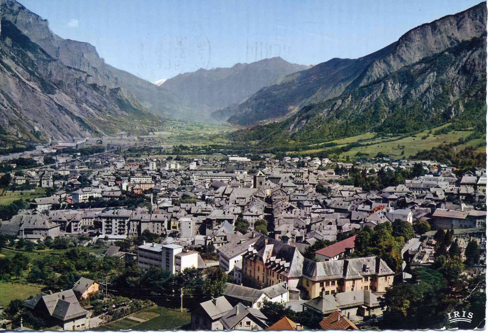
St. Jean de MaurienneSaint-Jean-de-Maurienne  is a commune in the Savoie department in the Rhône-Alpes region in south-eastern France. It is a sub-prefecture of the department. It lies in the Maurienne, the valley of the River Arc.

The oldest possessions of the Counts of Savoy were the countships of Maurienne, Savoy proper (the district between Arc, Isère, and the middle course of the Rhone), and Belley, with Bugey as its chief town.

The Duchy of Savoy, which had been a French-speaking province under the sovereignty of the Kingdom of Sardinia-Piedmont, was invaded by Revolutionary France, but restored to Piedmont in 1815. It became part of France in 1859, after the Second Italian War of Independence.

The town was reached by the Aix-les-Bains-Saint-Jean-de-Maurienne railway in 1857.

A paradise for grimpeurs, Saint-Jean-de-Maurienne finds itself at the heart of the most presitgious cycling area: the Galibier, the Madeleine, the Glandon, the Croix-de-Fer, the Telegraphe…it is at the crossroads of all the mythical cols and the famous climbs, like that of La Toussuire. All cyclists, whether touring, casual or bikers are guaranteed to find happiness here. Gateway to the Sybelles, Saint-Jean-de-Maurienne allows access to many winter resorts and to the discovery of the flora and fauna of the Vanoise National Park nearby. Historic capital of the valley, Saint-Jean also offers a rich heritage as a Pays d’Art et d’Histoire: gothic cathedral and cloisters, crypt where you can see roman art, costume museum, the Museum of Mont Corbier (liquour made from plants picked in the surrounding mountains), and of course, the Opinel Museum, the famous knife invented more than 120 years ago a few steps away from the town. Its cultural programme is as equally busy: spectacles, concerts, open air cinema and on Thursday 2nd August the traditional Saint-Jean Bread Festival.

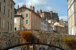
Annonay DavezieuxAnnonay Davézieux a commune in the Ardèche department in southern France, is a new stage town

At the heart of the green Ardeche, Annonay Davezieux has given birth to world recognised inventors and industrialists. Who would think that here, north of the Ardeche, you would find the cradle of air and space conquest or suspension bridges? On the 14th December 1782, the Mongolfier brothers, Joseph and Etienne, created the first aerostat in the garden of their paper mill in Vidalon; their great nephew Marc Seguin, talented engineer, followed in their footsteps in designing bridges and in developing trains whilst their descendants would prove themselves with aeroplane engines. Annonay is also a town with narrow lanes packed with history and of the memory of the statesman Boissy d’Anglas, father of the Constitution of the Year III. It still resounds with the noises of the tanneries and paper mills, of the well known Canson and other captains of industry. But the economic capital of the Ardeche, situated less than an hour from Lyon and Valence doesn’t just live in the past. Full of savoir-faire the city has attracted new dynamic activites notably in the fields of mechanics, medicine and food processing.  

Le Tour de France 2012: Stage 11

The Tour de France 2012, the world’s premier cycling event kicked off last Saturday with the Prologue in Liège, Belgium and will conclude on July 22 with the traditional ride into Paris and laps up and down the Champs-Élysées. Over the next 22 days the race will take its course briefly along the Northwestern coast of France through  Boulogne-sur-Mer, Abbeville and into Rouen then into the mountains of the Jura, Swiss Alps and the Pyrenees.

We will be Live Blogging Le Tour 2012 every morning at The Stars Hollow Gazette starting at 7:30 AM EDT. Come join us for a morning chat, cheer the riders and watch some of the most beautiful and historic countryside in Europe.

Albertville / La Toussuire – Les Sybelles 148 km

In the heart of the Alps, Albertville is situated in the Combe de Savoie on the verge of the Tarentaise, Beaufortain and the Val d’Arly, that gave it its nickname of the Crossroads of the four valleys. With its medieval city of Conflans, it is graced with a double label of Town of Art and History and Cycling Tourism Town which allows it to bridge the gap between heritage and sporting activities. So, don’t hesitate in visiting the town centre, bustling with its shops and welcoming sunlit terraces. Take a break in the Olympic Park and 20 years later, relive the emotion of the 1992 Winter Olympics at the foot of the mast made famous by Philippe Decoufle, the producer of the opening ceremony. Visit the Sarrazine Tower, the Red House, the Saint-Grat church or the Manuel de Locatel Castle. Albertville also opens its doors onto lakes and the surrounding mountains and offers a large choice of walks on foot or on bike. The proximity of Lake Annecy, the Bauges Nature Park, Beaufortain and the Tarentaise makes it an ideal base for taking a break and catching your breath.

Albertville is situated on the Arly River, close to the confluence with the Isère River. Its altitude is between 345 and 2,037 metres

The town was founded in 1836 by the Sardinian king Charles Albert. It also consists of the medieval town of Conflans, which has buildings dating back to the 14th century. Since then, Albertville has developed trade between France, Italy, and Switzerland; and industries such as paper mills and hydroelectricity can be found on its river.

In 2003, the town was labelled a “Town of art and history”.

La Toussuire – Les Sybelles

La Toussuire La Toussuire – Les Sybelles is a French linked ski area, located in the Savoie department in the Alps. It is one of the largest skiable domains in France. The ski station is also used regularly as the finish of cycle races including the Tour de France and the Critérium du Dauphiné.

La Toussuire has a head that turns. Perched on its plateau of alpine pastures it offers a 360 degree panorama on the majestic Aguilles d’Arves, the mountain passes of the Croix de Fer and of Glandon and the eternal glaciers. La Toussuire is the birthplace of Jean-Pierre Vidal, slalom gold medallist at the 2002 Winter Olympics in Salt Lake City and Gabriel Rivas, junior French champion and is the doorway to the domaine of Sybelles. In the winter, its 310 kilometres of pistes, that form the largest ski area in Maurienne, connects six resorts, Le Corbier, Les Bottieres, Saint-Colomban-des-Villards, Saint-Jean-d’Arves, Saint-Sorlin-d’Arves and La Toussuire, to which has just been added the two 45 kms of the neighbouring resorts, Albiez-le-Jeune and Albiez-Montrond. When summer returns, nature is more gentle: you can recharge your batteries in the sun, take in the pure water of the mountains, breathe in the fresh air, go mountain biking or walk on pedestrian trails. The climb towards La Toussuire and the surrounding passes make up one of the largest cycling areas in the world, the Maurienne Valley.

Click on images to enlarge

Le Tour de France 2012: Stage 9

The Tour de France 2012, the world’s premier cycling event kicked off last Saturday with the Prologue in Liège, Belgium and will conclude on July 22 with the traditional ride into Paris and laps up and down the Champs-Élysées. Over the next 22 days the race will take its course briefly along the Northwestern coast of France through  Boulogne-sur-Mer, Abbeville and into Rouen then into the mountains of the Jura, Swiss Alps and the Pyrenees.

We will be Live Blogging Le Tour 2012 every morning at The Stars Hollow Gazette starting at 7:30 AM EDT. Come join us for a morning chat, cheer the riders and watch some of the most beautiful and historic countryside in Europe.

Stage 10:  Mâcon – Bellegarde-sur-Valserine 194.5 km

Tuesday’s rest day and Wednesday’s start are in the town of Mâcon a small city (commune) in central France, in the region of Bourgogne, and the capital of the Mâconnais district. Mâcon is home to over 35,000 residents, called Mâconnais.

The city lies on the western bank of the Saône river, between Bresse in the East and the Beaujolais hills in the South. Mâcon is the southernmost city in the region of Burgundy. It is located 65 kilometres north of Lyon and 400 kilometres from Paris. The Saône river runs through the town.

Mâcon was a major crossroads in Roman times, and grapes would have been brought by the Romans if they were not already cultivated by the Celts. Viticulture was further encouraged by local religious foundations; the province was dominated by the bishopric of Mâcon during the Dark Ages.

The region formed the border between the Kingdom of France and the Holy Roman Empire from 843-1600 and grew rich on customs duties in that time. A secular Count of Mâcon is not recorded until after 850; from 926 the countship became hereditary. The last Count of Mâcon and of Vienne died in 1224 and the lands passed to his daughter, Alix de Bourgogne (Alice of Burgundy); when her husband died in 1239, she sold the Mâconnais to Louis IX of France. The 1435 Treaty of Arras saw Charles VII of France cede it to Philip, Duke of Burgundy, but in 1477 it reverted to France, upon the death of duke Charles the Bold. Emperor Charles V definitively recognized the Mâconnais as French at the Treaty of Cambrai in 1529.

After the fall of the Bastille in 1789, the mountain peasants of Mâconnais revolted. Many were executed by the urban militias of Mâcon, Cluny and Tournus after much brigandage.

The area west and north of Mâcon produces well-known wines from the Chardonnay grape. The best known appellation of the Mâconnais is Pouilly-Fuissé. Almost all the wine made in the Mâconnais is white wine. Chardonnay is the main grape grown, in fact there is a village of that name in the far north of the region. Some plantations of Gamay and Pinot Noir is made into red and rosé Mâcon, making up no more than 30% of the total wine production. Gamay is grown in the Beaujolais cru of Moulin-à-Vent which extends into the Mâconnais, but has little in common with the wines north of the border.

After 194.5 km and a 17.4 km climb up the Col du Grand Colombier. the race ends in Bellegarde-sur-Valserine, a commune in the Ain department in eastern France, located at the confluence of the Valserine and the Rhone.

The New York Times featured an article on this small industrial town nestled in the Jura Mountains:

It was last August when Régis Petit, the mayor of this small industrial town nestled in the Jura Mountains, received an unexpected phone call from Tour de France director Christian Prudhomme. [..]

Petit, a lifelong resident who has been mayor since 2003, was shocked. More than 250 French towns had applied to host the Tour; neither Petit, nor anyone else in Bellegarde, had sent in an application. But he quickly regained his wits.

“We said yes right away,” Petit said. “You can’t refuse the Tour de France.”

On Wednesday, this town of 12,000 will see its population temporarily triple as the race arrives here for the first time in history. [..]

In the late 19th century, it was one of the first French towns to have public electricity, thanks to a hydro-electric dam built on the Rhône. The electrification of the town, combined with its central position on a rail line from Lyon to Geneva, which is about 40 kilometers to the east, created a factory boom. Until the 1970s, textile, paper and electrometallurgy factories dominated the Bellegarde economy. Since then, outsourcing has rendered industry here a shell of its former self. “The factory of the world is in China now,” said Petit. “It’s sad, but it’s like that.”

In the last decade, Petit and a group of town leaders have tried to wallpaper over the town’s industrial past with projects aimed at increasing a white-collar work force, including the new train station, an architecturally incongruous plastic dome that stands out amid Bellegarde’s terra cotta roofs and modern apartment buildings. The €12 million high-speed rail hub has put the Champs-Élysées within three hours. It is an endeavor that makes what that the town is spending to host the Tour look like pocket change.

Le Tour de France 2012: Stage 9

The Tour de France 2012, the world’s premier cycling event kicked off last Saturday with the Prologue in Liège, Belgium and will conclude on July 22 with the traditional ride into Paris and laps up and down the Champs-Élysées. Over the next 22 days the race will take its course briefly along the Northwestern coast of France through  Boulogne-sur-Mer, Abbeville and into Rouen then into the mountains of the Jura, Swiss Alps and the Pyrenees.

We will be Live Blogging Le Tour 2012 every morning at The Stars Hollow Gazette starting at 7:30 AM EDT. Come join us for a morning chat, cheer the riders and watch some of the most beautiful and historic countryside in Europe.

Stage 9 – Arc-et-Senans – Besançon 41.5 km

Stage 9 was the Individual Time Trials. No teams to protect the riders, no peloton, just the rider, 41.5 km and the clock. The race started in two lovely French cities, Arc-et-Senans and ended in Besançon.

Arc-et-Senans

• Stage town on 1 previous occasion

• 1,500 inhabitants

• commune of Doubs

Arc-et-Senans was chosen by Louis XV to house the Royal Saltworks in 1771, but it waited until 1996 to see the Tour’s peloton. It was during a stage which set off from there, in Doubs, which finished in Aix-les-Bains. A novice called Michael Boogerd was the winner and this was the first of two victories in the Tour de France for the Dutch rider.

The [Saline Royale (Royal Saltworks) is a historical building at Arc-et-Senans in the department of Doubs, eastern France. It is next to the Forest of Chaux and about 35 kilometers from Besançon. The architect was Claude-Nicolas Ledoux (1736-1806), a prominent Parisian architect of the time. The work is an important example of an early Enlightenment project in which the architect based his design on a philosophy that favored arranging buildings according to a rational geometry and a hierarchical relation between the parts of the project.

The Institut Claude-Nicolas Ledoux has taken on the task of conservator and is managing the site as a monument. UNESCO added the “Salines Royales” to its List of World Heritage Sites in 1982.

Today, the site is mostly open to the public. It includes, in the building the coopers used, displays by the Ledoux Museum of other futuristic projects that were never built. Also, the salt production buildings house temporary exhibitions.

The train line from Besançon to Bourg-en-Bresse passes just next to the salt works. The station for Arc-et-Senans is only a few dozen meters from the site.

Besançon

• Stage town on 18 previous occasions

• 123,000 inhabitants

• Prefecture of Doubs

The prefecture city of Doubs was already on the 1905 Tour map, which makes it the oldest city associated with the race, after Paris, on the 2012 route. The first finish in Besançon is one of the race’s historical stages as the riders, who had set off from Nancy, went over the Ballon of Alsace, a difficulty which symbolized the future ascents in the mountains, for the first time. In 2009, Russia’s Sergei Ivanov was the winner there, by shaking off the other breakaway riders not long before the citadel came into sight. And on the subject of time-trials, Lance Armstrong won the last one organised in Besançon in 2004.

Besançon is the capital and principal city of the Franche-Comté region in eastern France. Once proclaimed first green city of France, it has been labeled a ‘Town of Art and History’ since 1986, and has been on the UNESCO world heritage list since 2008. [..]

The city is first recorded in 58 BC as Vesontio in the Book I of Julius Caesar’s Commentarii de Bello Gallico. The etymology of Vesontio is uncertain. The most common explanation is that the name is of Celtic origin, derivated from wes, meaning ‘mountain’. During the 4th century, the letter B took the place of the V, and the city name changed to Besontio or Bisontion and then underwent several transformation to become Besançon in 1243.  [..]

The city has one of the most beautiful historic centers of any major town in France. A broad horse-shoe of the river Doubs, “la Boucle”, encircles the old town, while Vauban’s imposing Citadelle blocks off the neck. The historic center presents a remarkable ensemble of classic stone buildings, some dating back to the Middle Ages and others to the Spanish Renaissance. Among the most visited historic monuments are:

    * several Roman remains,

    * the 16th century Palais Granvelle,

    * Vauban’s citadel (Citadel of Besançon)

    * the Cathedral of St. Jean,

    * several Spanish Renaissance-style buildings

    * the Église de la Madeleine, and

    * the river frontage.

The Roman remains consist primarily of the Porte Noire, a 2nd century CE triumphal arch at the foot of the hill on which the citadel stands, and the Square Castan, a semi-circular amphitheater. The Porte Noire may commemorate the victories of Marcus Aurelius over the Germans in 167 CE. It was partly rebuilt in 1820.

From 1534 to 1540, Cardinal Granvelle, chancellor to the Habsburg emperor Charles V, built the Palais Granvelle, in the heart of the town. It consists of arcades that surround an interior court, and is the most interesting of the secular buildings. The Palais contains a set of seven wool and silk blend tapestries from Bruges that were woven circa 1635 and that celebrate seven milestones in Charles V’s life. These tapestries remained in Spain until 1888, when they were transferred to France. In 1950 they were transferred to the Palais .

UNESCO added the citadel, the city walls and Fort Griffon to its list of World Heritage Sites in 2008, as part of the “Fortifications of Vauban” group. Some older military architecture has also survived. There is a cylindrical, 15th century tower near the Porte Notre-Dame, the southern gate of the city. The Porte Rivotte, a 16th century gate, has two round towers. The citadel houses the Museum of the French Resistance and Deportation.

The Cathedral, which dates largely from the 12th century though construction continued into the 14th century, contains the most remarkable of the city’s masterpieces, a massive Virgin and saints altarpiece by the Italian Renaissance painter Fra Bartolomeo. It also houses a noteworthy 19th century astronomical clock. The Cathedral has two apses, with the eastern apse and the tower dating from the reign of Louis XV.

Attractive quays border the old city, and in places there are shady promenades. On the right bank there is a bathing establishment in the Mouillere quarter that draws its water from the saline springs of Miserey-Salines.

Le Tour de France 2012: Stage 8

The Tour de France 2012, the world’s premier cycling event kicked off last Saturday with the Prologue in Liège, Belgium and will conclude on July 22 with the traditional ride into Paris and laps up and down the Champs-Élysées. Over the next 22 days the race will take its course briefly along the Northwestern coast of France through  Boulogne-sur-Mer, Abbeville and into Rouen then into the mountains of the Jura, Swiss Alps and the Pyrenees.

We will be Live Blogging Le Tour 2012 every morning at The Stars Hollow Gazette starting at 7:30 AM EDT. Come join us for a morning chat, cheer the riders and watch some of the most beautiful and historic countryside in Europe.

Stage 8 – Belfort – Porrentruy 157.5 km

Stage 8 went into the mountains of the Jura, starting in the French village of Belfort over seven mountains, the last, the Col de la Croix, a category 1 with an 800 meter 17% climb at the top. From the summit. it was a downhill race to the finish in Porrentruy, the Jurassic Park of Switzerland.

Belfort

• Stage town on 29 previous occasions

• 51,500 inhabitants

• Head of the Territoire de Belfort

The renowned Lion of Belfort, sculpted by Bartholdi, has seen many champions pass by in the long history of the city, which was the next stage after Metz on the Tour’s route in 1907. A very regular stage of the Tour in the years before the war, the city has often served more often as a stage start than a finish, although Marc Demeyer, the official trailblazer of Freddy Maertens, seized the opportunity in turn to excel there, in 1978. The next day, Bernard Hinault, won the time-trial which allowed him to oust Zoetemelk from the top of the general classification and to wear the Yellow Jersey on the Tour de France for the first time.

Belfort  is a city in north-east France in the Franche-Comté région, situated between Lyon and Strasbourg. The residents of the city are called ”Belfortains”. It is located on the Savoureuse, on the strategically important natural route between the Rhine and the Rhône – the Belfort Gap (Trouée de Belfort) or Burgundian Gate (Porte de Bourgogne).

Belfort is the home of the Lion of Belfort, a sculpture by Frédéric Bartholdi expressing people’s resistance against the siege in the Franco-Prussian War (1870) – who shortly afterwards built the Statue of Liberty in New York.

History

Belfort’s strategic location, in a natural gap between the Vosges and the Jura, on a route linking the Rhine and the Rhône, has attracted human settlement and made it a target for armies.

The site of Belfort was inhabited in Gallo-Roman times and was subsequently recorded in the 13th century as a possession of the counts of Montbéliard, who granted it a charter in 1307.

Previously an Austrian possession, Belfort was transferred to France by the Treaty of Westphalia (1648), that ended the Thirty Years’ War. The town’s fortifications were extended and developed by the military architect Vauban for Louis XIV.

Until 1871, Belfort was part of the département of Haut-Rhin, in Alsace. The Siege of Belfort, between 3 November 1870 and 18 February 1871, was successfully resisted until the garrison was ordered to surrender 21 days after the armistice between France and Prussia. Because this part of Alsace was French speaking, while the rest of Alsace was German speaking, the area around Belfort was not annexed by the Prussians. It formed, as it still does, the Territoire de Belfort. The siege is commemorated by a huge statue, the Lion of Belfort, by Frédéric Bartholdi.

The town was bombarded by the German army during World War I and occupied by it during World War II. In November 1944 the retreating German army held the French First Army before the town until French Commandos made a successful night attack on the Salbert Fort. Belfort was liberated on 22 November 1944.

Porrentruy

• Stage town for the first time

• 6,700 inhabitants

• Cantonal commune of Jura (Switzerland)

The Franco-Swiss stages sometimes carry a lot of weight in the race’s scenario when the Tour goes there. This was the case for example, in 2009 in Verbier, when Alberto Contador dealt a decisive blow to his rivals; or going back a bit further to Crans-Montana, the resort where Laurent Fignon maintained his advantage over Bernard Hinault in 1984. As it so happened, several weeks earlier, the title holder had won a stage in Porrentruy, where the Tour de Romandie goes regularly. More recently a prologue won by Italy’s Marco Pinotti was organised there in 2010, whereas the finish of the last straight stage in 2006 favoured America’s Chris Horner.

Porrentruy is a Swiss municipality and seat of the district of the same name located in the canton of Jura.

History

The first trace of human presence in Porrentruy is a mesolithic tool that was found in the back yard of the Hôtel-Dieu. Scattered, individual objects have also been found from the neolithic, the late Bronze Age and the Iron Age. The first known settlement in what became Porrentruy goes back to the Roman era. In 1983, the ruins of a Gallo-Roman temple were discovered in the cemetery on the north of town, and Roman coins were found there. Near the town, a kilometer long (0.6 mile) section of the Augst-Epomanduodurum (now Mandeure) Roman road was discovered.

In the back yard of the Hôtel-Dieu the charred remains of a building from the 10th or 11th century were discovered. However, the first historical mention of the name occurs in 1136 as Purrentru. The name presumably comes from the Latin pons Ragentrudis (Ragentrud bridge). Ragentrud was the wife of the Frankish King Dagobert I. The German form of the name, Pruntrut may have a separate etymology from Bruntrutum, which means an abundant spring.

The first settlement was established in 1140 in the vicinity of Church of Saint-Germain, which was built in the Early Middle Ages. The Counts of Pfirt, who owned the region around Porrentruy, built a castle on a defensible hill and made it the capital of the Ajoie territory. A settlement (now known as the Faubourg de France) was founded at the foot of the castle, with another south on the opposite hill. The city wall was probably built before 1283 and surrounded the two settlements, but not the parish church of Saint-Germain.

In 1236 the Counts of Pfirt pledged the town to the Counts of Montbeliard, however, they retained their rights to the Ajoie until 1281 when they sold the territory to the Bishop of Basel. The Counts of Montbéliard refused to hand over Porrentruy, which led Bishop Henry of Isny to request support from King Rudolph I of Habsburg. After six weeks under siege, the Count relented and handed it over to the Bishop. On 20 April 1283, the The king asked the Bishop of Basel to grant Porrentruy a town charter and make it a free Imperial city. While the Counts of Montbéliard retained some power in the town, their influence waned during the 13th century. [..]

The first parish church of Saint-Germain was replaced in the 13th century by a new building, which underwent several renovations. The Church of Saint-Pierre was completed in 1349 and became the parish church in 1475. The cathedral chapter was established in 1377. Several religious orders were active in the city, including the Jesuits who built their college in 1591. In addition to the Jesuits other orders included the Ursulines (1619), the Sisters of the Annonciade (permanently established in 1646) and the Capuchins (1663).

The first uprising against the Bishop’s power was under the Comité de la Commune de Porrentruy on 20 August 1790, but they were unable to expel the Bishop. However, on 27 April 1792, French Revolutionary troops invaded the city and drove the Bishop out. Porrentruy became the capital of a dependent republic, which was then incorporated into France in 1793 as the Département du Mont Terrible. In 1800, this department was incorporated into the Département du Haut-Rhin as a sub-département. During the War of the Sixth Coalition against Napoleon, Allied troops entered Porrentruy on 24 December 1813. Following their liberation, the future of this former episcopal seat was uncertain. The government divided into two parties, the Episcopal party that sought the return of the prince bishop as the head of a Swiss canton, while the French party wanted to retain the current secular government. However, soon after the fall of Napoleon, the municipality was given to the Canton of Bern (in 1815) to compensate for the loss of the Canton of Vaud, which had become a separate canton in 1803.

Both factions, the religious and the secular, retained power in the town in the following years. The political life in 19th century was characterized by the severe conflict between Liberal-Radicals and the Catholic Conservatives. The secular side gained power in 1860, when the mayor, Joseph Trouillat, was forced out of office. The Radicals retained the mayor’s office and a majority of the town council from 1860 until 1972.

Click on images to enlarge

Load more