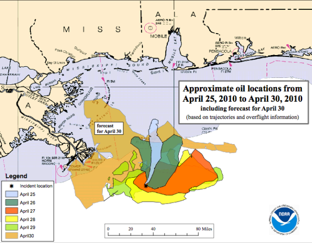
The BP Deepwater Horizon drilling rig failed on Tuesday evening April 20, 2010, 14 days ago.
This is what it looked like Saturday, May 1st. I took a satellite picture from the NRL Monterey of the Gulf of Mexico that was showing biological substances, cropped it, and color enhanced it by playing with the settings on iphoto, to make the colors have more contrast. Since oil is based on organics, this made it show up better, and I could recreate, roughly, what the LSU ESL was doing to get the oil to show up on their pictures I posted previously. Because there were thunderstorms this past weekend, the area was obscured by cloud cover often. I also noticed the government was not putting up daily picture updates.
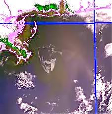
May 1, 2010 BP Deepwater Horizon’s oil slick in the Gulf of Mexico, photo NRL Monterey, color enhanced by ARC The thicker part of the slick is the part that looks like a bird’s beak pointing upside down off the New Orleans Louisiana Delta, which is to the left in green and pink. Pink is the coastline, drawn in. The greenish tint is where the slick is thinner. The blue is the water.
*
*
This is the same picture from May 1st, larger area, without my increasing the color contrast.
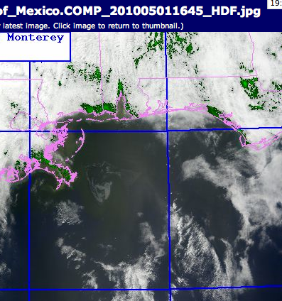
May 1, 2010, BP Deepwater Horizon’s Oil slick in the Gulf of Mexico, photo NRL Monterey. The heavier part of the slick is gray, the lighter part of the slick is very hard to see, but is there and greenish grey. The coast outline is drawn in pink by the website. The ^ triangle to the north in the shoreline is the Bay of Mobile, Alabama. To find the origin of the slick, look down from the left side of that triangle of the Mobile Bay and come out from the Delta about at a 45º degree angle, where the lines would meet, is roughly where the broken drill rig is. Where the up and down brilliant blue longitude line is to the right touches shore, is where Pensicola Bay is in the Florida panhandle.
*
*
As you can see from this larger view, the slick actually has spread quite a bit towards the Florida Panhandle by Saturday the 1st.
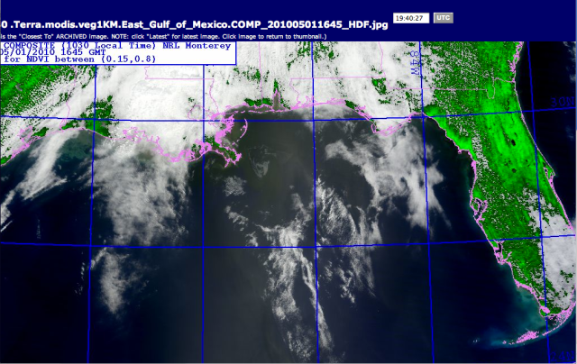
5/1/2010, Larger view of Gulf with BP DH Oil slick southwest of the New Orleans delta, spreading towards Alabama and Florida.
*
*
Sunday May 2- This lovely overlay picture below is the satellite of the eastern half of the US, including the gulf of Mexico, with the wind direction and speed marked on it. Think of the little color icons as brooms with the stick end pointing towards what way the wind is going, and the bigger the broom, the faster. There were several thunderstorm fronts moving thru to the southeast, and the wind in the Gulf is spinning in a clockwise manner, driving the waves and the oil around and around and easterly at the same time.
This is known as the “Conveyer Belt.” photo NRL Monterey
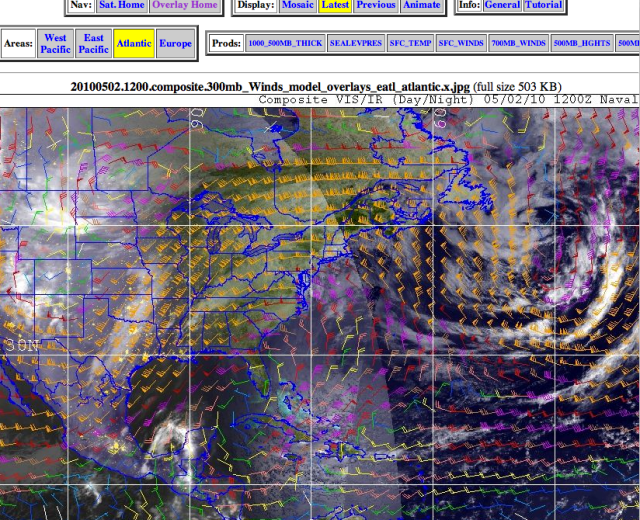
Wind Direction on Sunday the 2nd, showing the Gulf’s classic “Conveyor Belt.”
The other thing you can see here is a big low pressure system spinning off the eastern coast and it’s spinning counterclockwise. Look at Florida. Now look at Cuba, the long island under it, then to its right, the island with Haiti and the Dominican Republic, and to the right of that, little bitty Puerto Rico, the rectangle island.
Do you see how small Puerto Rico is ? Do you see how big the oil slick is, in the first picture ? Do you know how stupid White House Correspondent Cokie Roberts looked, prattling about how the oil slick is so big it was as big as Puerto Rico, all day Saturday, when she wasn’t blathering about the White House Correspondent’s dinner ?


