Tag: Discoverer Inspiration

New Cap for Leaking Oil Well as Slick Blows Towards Texas, & More Alaska Drilling

Just when you thought we were up to our a$$es in oily alligators,  the Obama Administration Department of the Interior announces plans to open 1.8 million acres of Alaska’s National Petroleum Reserve to bidding on 190 new tracts for NEW OIL AND GAS DRILLING.   Bidding will open Aug 11.

Gotta Love Grist. Called it The Dept of Not Learning.      http://www.grist.org/article/2…

It’s only another 1.8 million acres.

http://interior.gov/news/press…

Increases number of oil/gas wells by 60% from 310 to 500.

Increases number of acres under drilling  by 60% from 3 million  to 4.8 million

Teshekpuk Lake is 80 miles east of Point Barrow on the northern Alaska coastline, which is already being damaged by the warming climate and melting arctic sea ice.  Up to 90,000 geese use the area to molt every summer, and the Indigenous people use part of the local caribou herd to survive by subsistence hunting.

http://en.wikipedia.org/wiki/T…

____

The BP Oil Slick is Blowing Towards Texas.  Here’s the satellite image from NASA, Friday, July 9th,  from 1 km up in space

http://rapidfire.sci.gsfc.nasa…
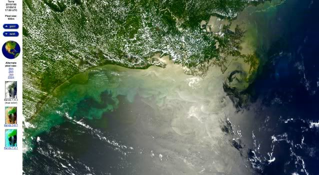
BP oil spill,texas coast,achalafalay bay

Friday, July 9, 2010.  Oil slick heads west towards Texas coast. photo NASA
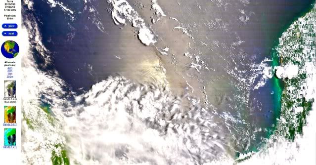
BP oil spill,yucatan penninsula,texas coast,achalafalay bay

Oil Slick now extends south all the way to the east of the Yucatan Peninsula in Mexico.  This is the bottom half of the same image of the Gulf of Mexico on 7/9/10 as above. photo NASA

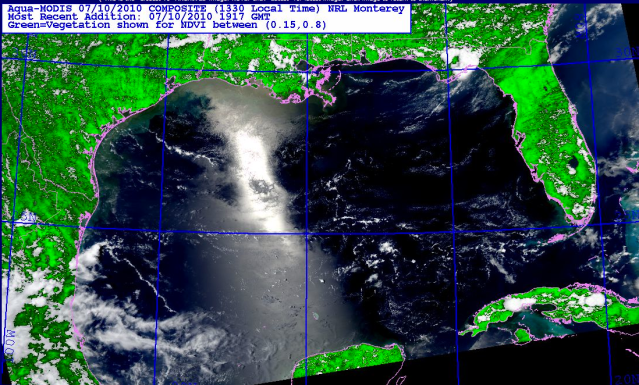
photo from today, Saturday July 10, 2010

Gulf,BP Oil Spill,texas coastline,nature,tragedy

Today, July 10, 2010, Gulf of Mexico.  Winds are now shifting to come out of the west/southwest again after an east wind drove this oil towards Texas earlier this week.    But the oil to the south near the Yucatan peninsula,  is probably going to continue to go west, then north again,  with the natural Gulf clockwise current.   photo, NRL Monterey, biomass, satellite Aqua