Tag: TMC Sports

Le Tour de France 2012: Stage 13

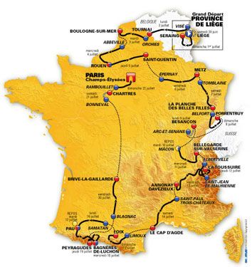
The Tour de France 2012, the world’s premier cycling event kicked off last Saturday with the Prologue in Liège, Belgium and will conclude on July 22 with the traditional ride into Paris and laps up and down the Champs-Élysées. Over the next 22 days the race will take its course briefly along the Northwestern coast of France through  Boulogne-sur-Mer, Abbeville and into Rouen then into the mountains of the Jura, Swiss Alps and the Pyrenees.

We will be Live Blogging Le Tour 2012 every morning at The Stars Hollow Gazette starting at 7:30 AM EDT. Come join us for a morning chat, cheer the riders and watch some of the most beautiful and historic countryside in Europe.

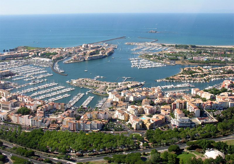
Saint-Paul-Trois-Châteaux – Le Cap d’Agde 217 km

Saint-Paul-Trois-Châteaux Cathedral is a commune in the Drôme department in southeastern France. The name of the city comes from the Gaul tribe of the Tricastini. Local historians incorrectly concluded that the name was derived from the Latin “Tricastinorum”, meaning three castles.

Saint-Paul-Trois-Châteaux is a charming village in the Drôme Provençale, which nestles among vineyards, truffle oaks and fields of lavender, and manages to combine heritage, the land, authenticity and conviviality. Beneath it, the village’s former inhabitants have left behind a number of relics from the prehistoric age, from antiquity and the middle Ages. The mediaeval cathedral, a remarkable example of Roman architecture, is emblematic of the town, sitting majestically in the centre of the village. Inside the city walls, you will discover a host of attractions: mansions, charming little squares adorned with fountains and outdoor cafes. Saint-Paul-Trois-Châteaux is also a gastronomic delight, best known for its truffles, providing 60 per cent of France’s truffles to the market, as well as its wine (AOC wines from Grignan-les-Adhémar) and its many great restaurants. The influence of the village also goes beyond its walls – it’s also known for its children’s book festival, its soul jazz festival, its classical music festival – Les Musicales en Tricastin – and a film festival.

Le Cap d’Agde

Le Cap d'Agde Cap d’Agde is the seaside resort of the town of Agde, France, on the Mediterranean sea in the département of Hérault, within the région of Languedoc-Roussillon.  Cap d’Agde is one of the largest leisure ports on the French Mediterranean. Development as a tourist resort started in the 1970s before which time the only buildings at the Cap were small houses typically used for weekends by local people.

Set up at the beginning of the 1970s, the Cap d’Agde resort has become, in the space of 40 years, a leading example of a seaside holiday resort with today nearly 175,000 overnight stays. Created by the Interministerial Mission for Territory Management, headed by Pierre Racine, designed by architect Jean Le Couteur, in 2010 it saw its Port Saint-Martin district named Heritage of the 20th Century. Le Cap d’Agde is the emblematic resort of the town of Agde, founded 2,600 years ago by the Greeks of Phocee. A stategic place due to its location in the Gulf of Lion, Agde is situated between the borders of three areas of water: the Mediterranean Sea, the Herault River and the Canal du Midi. Its economy, for a long time centred around the sea and viticulture, is today primarily based on tourism, since it welcomes at the height of the summer season up to 300,000 people. Agde, which means good fortune – from its Greek name Agathe Tyche – has retained many traces that make up its rich heritage including the largest French collection of bronze antiques found in situ and collected together at the Ephebe Museum.

Le Tour de France 2012: Stage 12

The Tour de France 2012, the world’s premier cycling event kicked off last Saturday with the Prologue in Liège, Belgium and will conclude on July 22 with the traditional ride into Paris and laps up and down the Champs-Élysées. Over the next 22 days the race will take its course briefly along the Northwestern coast of France through  Boulogne-sur-Mer, Abbeville and into Rouen then into the mountains of the Jura, Swiss Alps and the Pyrenees.

We will be Live Blogging Le Tour 2012 every morning at The Stars Hollow Gazette starting at 7:30 AM EDT. Come join us for a morning chat, cheer the riders and watch some of the most beautiful and historic countryside in Europe.

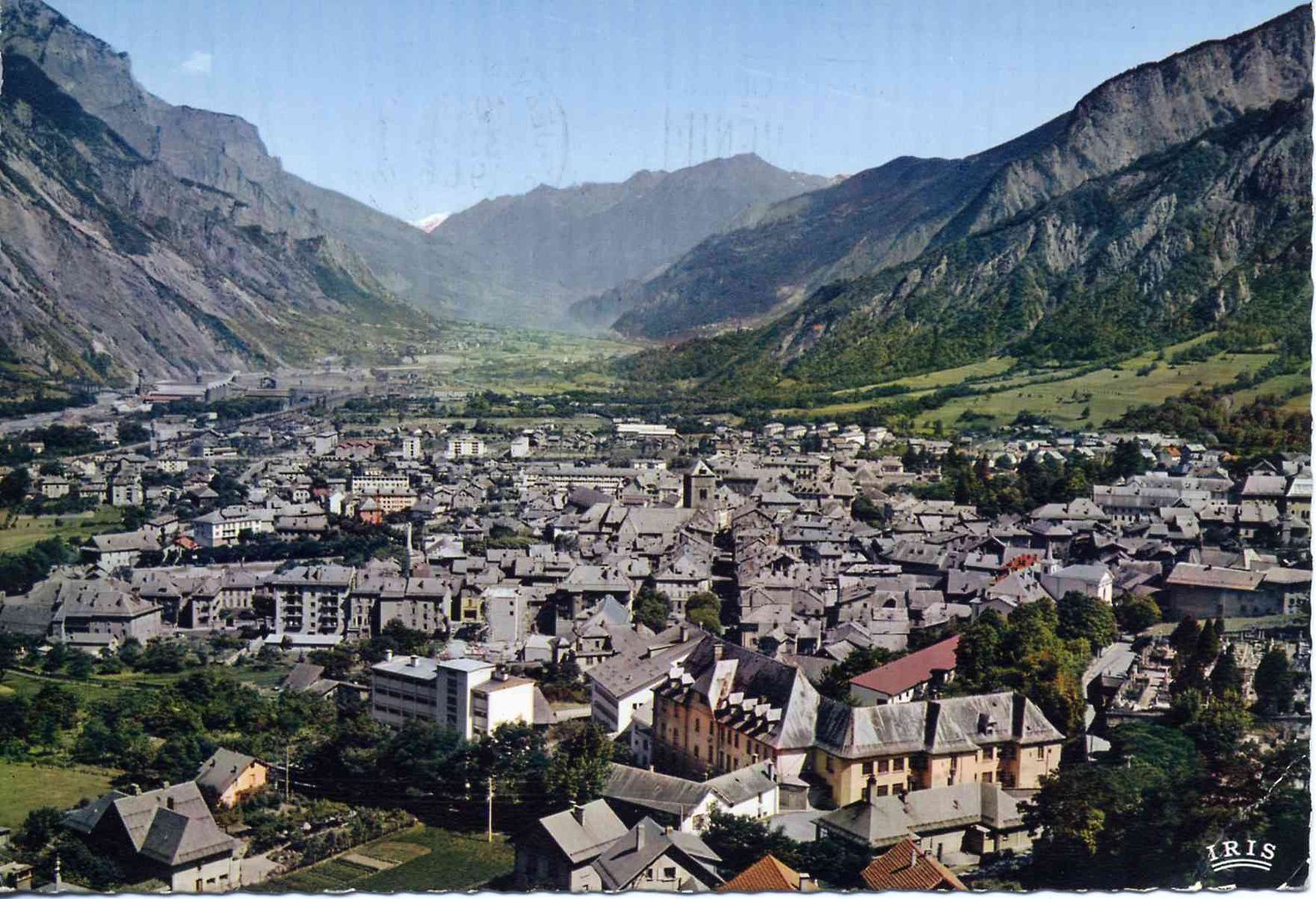
Saint-Jean-de-Maurienne – Annonay Davézieux 226 km

Saint-Jean-de-Maurienne

St. Jean de MaurienneSaint-Jean-de-Maurienne  is a commune in the Savoie department in the Rhône-Alpes region in south-eastern France. It is a sub-prefecture of the department. It lies in the Maurienne, the valley of the River Arc.

The oldest possessions of the Counts of Savoy were the countships of Maurienne, Savoy proper (the district between Arc, Isère, and the middle course of the Rhone), and Belley, with Bugey as its chief town.

The Duchy of Savoy, which had been a French-speaking province under the sovereignty of the Kingdom of Sardinia-Piedmont, was invaded by Revolutionary France, but restored to Piedmont in 1815. It became part of France in 1859, after the Second Italian War of Independence.

The town was reached by the Aix-les-Bains-Saint-Jean-de-Maurienne railway in 1857.

A paradise for grimpeurs, Saint-Jean-de-Maurienne finds itself at the heart of the most presitgious cycling area: the Galibier, the Madeleine, the Glandon, the Croix-de-Fer, the Telegraphe…it is at the crossroads of all the mythical cols and the famous climbs, like that of La Toussuire. All cyclists, whether touring, casual or bikers are guaranteed to find happiness here. Gateway to the Sybelles, Saint-Jean-de-Maurienne allows access to many winter resorts and to the discovery of the flora and fauna of the Vanoise National Park nearby. Historic capital of the valley, Saint-Jean also offers a rich heritage as a Pays d’Art et d’Histoire: gothic cathedral and cloisters, crypt where you can see roman art, costume museum, the Museum of Mont Corbier (liquour made from plants picked in the surrounding mountains), and of course, the Opinel Museum, the famous knife invented more than 120 years ago a few steps away from the town. Its cultural programme is as equally busy: spectacles, concerts, open air cinema and on Thursday 2nd August the traditional Saint-Jean Bread Festival.

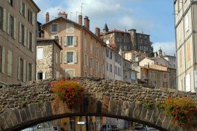
Annonay DavezieuxAnnonay Davézieux a commune in the Ardèche department in southern France, is a new stage town

At the heart of the green Ardeche, Annonay Davezieux has given birth to world recognised inventors and industrialists. Who would think that here, north of the Ardeche, you would find the cradle of air and space conquest or suspension bridges? On the 14th December 1782, the Mongolfier brothers, Joseph and Etienne, created the first aerostat in the garden of their paper mill in Vidalon; their great nephew Marc Seguin, talented engineer, followed in their footsteps in designing bridges and in developing trains whilst their descendants would prove themselves with aeroplane engines. Annonay is also a town with narrow lanes packed with history and of the memory of the statesman Boissy d’Anglas, father of the Constitution of the Year III. It still resounds with the noises of the tanneries and paper mills, of the well known Canson and other captains of industry. But the economic capital of the Ardeche, situated less than an hour from Lyon and Valence doesn’t just live in the past. Full of savoir-faire the city has attracted new dynamic activites notably in the fields of mechanics, medicine and food processing.  

Le Tour de France 2012: Stage 11

The Tour de France 2012, the world’s premier cycling event kicked off last Saturday with the Prologue in Liège, Belgium and will conclude on July 22 with the traditional ride into Paris and laps up and down the Champs-Élysées. Over the next 22 days the race will take its course briefly along the Northwestern coast of France through  Boulogne-sur-Mer, Abbeville and into Rouen then into the mountains of the Jura, Swiss Alps and the Pyrenees.

We will be Live Blogging Le Tour 2012 every morning at The Stars Hollow Gazette starting at 7:30 AM EDT. Come join us for a morning chat, cheer the riders and watch some of the most beautiful and historic countryside in Europe.

Albertville / La Toussuire – Les Sybelles 148 km

In the heart of the Alps, Albertville is situated in the Combe de Savoie on the verge of the Tarentaise, Beaufortain and the Val d’Arly, that gave it its nickname of the Crossroads of the four valleys. With its medieval city of Conflans, it is graced with a double label of Town of Art and History and Cycling Tourism Town which allows it to bridge the gap between heritage and sporting activities. So, don’t hesitate in visiting the town centre, bustling with its shops and welcoming sunlit terraces. Take a break in the Olympic Park and 20 years later, relive the emotion of the 1992 Winter Olympics at the foot of the mast made famous by Philippe Decoufle, the producer of the opening ceremony. Visit the Sarrazine Tower, the Red House, the Saint-Grat church or the Manuel de Locatel Castle. Albertville also opens its doors onto lakes and the surrounding mountains and offers a large choice of walks on foot or on bike. The proximity of Lake Annecy, the Bauges Nature Park, Beaufortain and the Tarentaise makes it an ideal base for taking a break and catching your breath.

Albertville is situated on the Arly River, close to the confluence with the Isère River. Its altitude is between 345 and 2,037 metres

The town was founded in 1836 by the Sardinian king Charles Albert. It also consists of the medieval town of Conflans, which has buildings dating back to the 14th century. Since then, Albertville has developed trade between France, Italy, and Switzerland; and industries such as paper mills and hydroelectricity can be found on its river.

In 2003, the town was labelled a “Town of art and history”.

La Toussuire – Les Sybelles

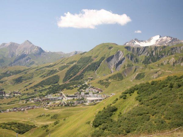
La Toussuire La Toussuire – Les Sybelles is a French linked ski area, located in the Savoie department in the Alps. It is one of the largest skiable domains in France. The ski station is also used regularly as the finish of cycle races including the Tour de France and the Critérium du Dauphiné.

La Toussuire has a head that turns. Perched on its plateau of alpine pastures it offers a 360 degree panorama on the majestic Aguilles d’Arves, the mountain passes of the Croix de Fer and of Glandon and the eternal glaciers. La Toussuire is the birthplace of Jean-Pierre Vidal, slalom gold medallist at the 2002 Winter Olympics in Salt Lake City and Gabriel Rivas, junior French champion and is the doorway to the domaine of Sybelles. In the winter, its 310 kilometres of pistes, that form the largest ski area in Maurienne, connects six resorts, Le Corbier, Les Bottieres, Saint-Colomban-des-Villards, Saint-Jean-d’Arves, Saint-Sorlin-d’Arves and La Toussuire, to which has just been added the two 45 kms of the neighbouring resorts, Albiez-le-Jeune and Albiez-Montrond. When summer returns, nature is more gentle: you can recharge your batteries in the sun, take in the pure water of the mountains, breathe in the fresh air, go mountain biking or walk on pedestrian trails. The climb towards La Toussuire and the surrounding passes make up one of the largest cycling areas in the world, the Maurienne Valley.

Click on images to enlarge

Le Tour de France 2012: Stage 9

The Tour de France 2012, the world’s premier cycling event kicked off last Saturday with the Prologue in Liège, Belgium and will conclude on July 22 with the traditional ride into Paris and laps up and down the Champs-Élysées. Over the next 22 days the race will take its course briefly along the Northwestern coast of France through  Boulogne-sur-Mer, Abbeville and into Rouen then into the mountains of the Jura, Swiss Alps and the Pyrenees.

We will be Live Blogging Le Tour 2012 every morning at The Stars Hollow Gazette starting at 7:30 AM EDT. Come join us for a morning chat, cheer the riders and watch some of the most beautiful and historic countryside in Europe.

Stage 10:  Mâcon – Bellegarde-sur-Valserine 194.5 km

Tuesday’s rest day and Wednesday’s start are in the town of Mâcon a small city (commune) in central France, in the region of Bourgogne, and the capital of the Mâconnais district. Mâcon is home to over 35,000 residents, called Mâconnais.

The city lies on the western bank of the Saône river, between Bresse in the East and the Beaujolais hills in the South. Mâcon is the southernmost city in the region of Burgundy. It is located 65 kilometres north of Lyon and 400 kilometres from Paris. The Saône river runs through the town.

Mâcon was a major crossroads in Roman times, and grapes would have been brought by the Romans if they were not already cultivated by the Celts. Viticulture was further encouraged by local religious foundations; the province was dominated by the bishopric of Mâcon during the Dark Ages.

The region formed the border between the Kingdom of France and the Holy Roman Empire from 843-1600 and grew rich on customs duties in that time. A secular Count of Mâcon is not recorded until after 850; from 926 the countship became hereditary. The last Count of Mâcon and of Vienne died in 1224 and the lands passed to his daughter, Alix de Bourgogne (Alice of Burgundy); when her husband died in 1239, she sold the Mâconnais to Louis IX of France. The 1435 Treaty of Arras saw Charles VII of France cede it to Philip, Duke of Burgundy, but in 1477 it reverted to France, upon the death of duke Charles the Bold. Emperor Charles V definitively recognized the Mâconnais as French at the Treaty of Cambrai in 1529.

After the fall of the Bastille in 1789, the mountain peasants of Mâconnais revolted. Many were executed by the urban militias of Mâcon, Cluny and Tournus after much brigandage.

The area west and north of Mâcon produces well-known wines from the Chardonnay grape. The best known appellation of the Mâconnais is Pouilly-Fuissé. Almost all the wine made in the Mâconnais is white wine. Chardonnay is the main grape grown, in fact there is a village of that name in the far north of the region. Some plantations of Gamay and Pinot Noir is made into red and rosé Mâcon, making up no more than 30% of the total wine production. Gamay is grown in the Beaujolais cru of Moulin-à-Vent which extends into the Mâconnais, but has little in common with the wines north of the border.

After 194.5 km and a 17.4 km climb up the Col du Grand Colombier. the race ends in Bellegarde-sur-Valserine, a commune in the Ain department in eastern France, located at the confluence of the Valserine and the Rhone.

The New York Times featured an article on this small industrial town nestled in the Jura Mountains:

It was last August when Régis Petit, the mayor of this small industrial town nestled in the Jura Mountains, received an unexpected phone call from Tour de France director Christian Prudhomme. [..]

Petit, a lifelong resident who has been mayor since 2003, was shocked. More than 250 French towns had applied to host the Tour; neither Petit, nor anyone else in Bellegarde, had sent in an application. But he quickly regained his wits.

“We said yes right away,” Petit said. “You can’t refuse the Tour de France.”

On Wednesday, this town of 12,000 will see its population temporarily triple as the race arrives here for the first time in history. [..]

In the late 19th century, it was one of the first French towns to have public electricity, thanks to a hydro-electric dam built on the Rhône. The electrification of the town, combined with its central position on a rail line from Lyon to Geneva, which is about 40 kilometers to the east, created a factory boom. Until the 1970s, textile, paper and electrometallurgy factories dominated the Bellegarde economy. Since then, outsourcing has rendered industry here a shell of its former self. “The factory of the world is in China now,” said Petit. “It’s sad, but it’s like that.”

In the last decade, Petit and a group of town leaders have tried to wallpaper over the town’s industrial past with projects aimed at increasing a white-collar work force, including the new train station, an architecturally incongruous plastic dome that stands out amid Bellegarde’s terra cotta roofs and modern apartment buildings. The €12 million high-speed rail hub has put the Champs-Élysées within three hours. It is an endeavor that makes what that the town is spending to host the Tour look like pocket change.

Le Tour de France 2012: Stage 9

The Tour de France 2012, the world’s premier cycling event kicked off last Saturday with the Prologue in Liège, Belgium and will conclude on July 22 with the traditional ride into Paris and laps up and down the Champs-Élysées. Over the next 22 days the race will take its course briefly along the Northwestern coast of France through  Boulogne-sur-Mer, Abbeville and into Rouen then into the mountains of the Jura, Swiss Alps and the Pyrenees.

We will be Live Blogging Le Tour 2012 every morning at The Stars Hollow Gazette starting at 7:30 AM EDT. Come join us for a morning chat, cheer the riders and watch some of the most beautiful and historic countryside in Europe.

Stage 9 – Arc-et-Senans – Besançon 41.5 km

Stage 9 was the Individual Time Trials. No teams to protect the riders, no peloton, just the rider, 41.5 km and the clock. The race started in two lovely French cities, Arc-et-Senans and ended in Besançon.

Arc-et-Senans

• Stage town on 1 previous occasion

• 1,500 inhabitants

• commune of Doubs

Arc-et-Senans was chosen by Louis XV to house the Royal Saltworks in 1771, but it waited until 1996 to see the Tour’s peloton. It was during a stage which set off from there, in Doubs, which finished in Aix-les-Bains. A novice called Michael Boogerd was the winner and this was the first of two victories in the Tour de France for the Dutch rider.

The [Saline Royale (Royal Saltworks) is a historical building at Arc-et-Senans in the department of Doubs, eastern France. It is next to the Forest of Chaux and about 35 kilometers from Besançon. The architect was Claude-Nicolas Ledoux (1736-1806), a prominent Parisian architect of the time. The work is an important example of an early Enlightenment project in which the architect based his design on a philosophy that favored arranging buildings according to a rational geometry and a hierarchical relation between the parts of the project.

The Institut Claude-Nicolas Ledoux has taken on the task of conservator and is managing the site as a monument. UNESCO added the “Salines Royales” to its List of World Heritage Sites in 1982.

Today, the site is mostly open to the public. It includes, in the building the coopers used, displays by the Ledoux Museum of other futuristic projects that were never built. Also, the salt production buildings house temporary exhibitions.

The train line from Besançon to Bourg-en-Bresse passes just next to the salt works. The station for Arc-et-Senans is only a few dozen meters from the site.

Besançon

• Stage town on 18 previous occasions

• 123,000 inhabitants

• Prefecture of Doubs

The prefecture city of Doubs was already on the 1905 Tour map, which makes it the oldest city associated with the race, after Paris, on the 2012 route. The first finish in Besançon is one of the race’s historical stages as the riders, who had set off from Nancy, went over the Ballon of Alsace, a difficulty which symbolized the future ascents in the mountains, for the first time. In 2009, Russia’s Sergei Ivanov was the winner there, by shaking off the other breakaway riders not long before the citadel came into sight. And on the subject of time-trials, Lance Armstrong won the last one organised in Besançon in 2004.

Besançon is the capital and principal city of the Franche-Comté region in eastern France. Once proclaimed first green city of France, it has been labeled a ‘Town of Art and History’ since 1986, and has been on the UNESCO world heritage list since 2008. [..]

The city is first recorded in 58 BC as Vesontio in the Book I of Julius Caesar’s Commentarii de Bello Gallico. The etymology of Vesontio is uncertain. The most common explanation is that the name is of Celtic origin, derivated from wes, meaning ‘mountain’. During the 4th century, the letter B took the place of the V, and the city name changed to Besontio or Bisontion and then underwent several transformation to become Besançon in 1243.  [..]

The city has one of the most beautiful historic centers of any major town in France. A broad horse-shoe of the river Doubs, “la Boucle”, encircles the old town, while Vauban’s imposing Citadelle blocks off the neck. The historic center presents a remarkable ensemble of classic stone buildings, some dating back to the Middle Ages and others to the Spanish Renaissance. Among the most visited historic monuments are:

    * several Roman remains,

    * the 16th century Palais Granvelle,

    * Vauban’s citadel (Citadel of Besançon)

    * the Cathedral of St. Jean,

    * several Spanish Renaissance-style buildings

    * the Église de la Madeleine, and

    * the river frontage.

The Roman remains consist primarily of the Porte Noire, a 2nd century CE triumphal arch at the foot of the hill on which the citadel stands, and the Square Castan, a semi-circular amphitheater. The Porte Noire may commemorate the victories of Marcus Aurelius over the Germans in 167 CE. It was partly rebuilt in 1820.

From 1534 to 1540, Cardinal Granvelle, chancellor to the Habsburg emperor Charles V, built the Palais Granvelle, in the heart of the town. It consists of arcades that surround an interior court, and is the most interesting of the secular buildings. The Palais contains a set of seven wool and silk blend tapestries from Bruges that were woven circa 1635 and that celebrate seven milestones in Charles V’s life. These tapestries remained in Spain until 1888, when they were transferred to France. In 1950 they were transferred to the Palais .

UNESCO added the citadel, the city walls and Fort Griffon to its list of World Heritage Sites in 2008, as part of the “Fortifications of Vauban” group. Some older military architecture has also survived. There is a cylindrical, 15th century tower near the Porte Notre-Dame, the southern gate of the city. The Porte Rivotte, a 16th century gate, has two round towers. The citadel houses the Museum of the French Resistance and Deportation.

The Cathedral, which dates largely from the 12th century though construction continued into the 14th century, contains the most remarkable of the city’s masterpieces, a massive Virgin and saints altarpiece by the Italian Renaissance painter Fra Bartolomeo. It also houses a noteworthy 19th century astronomical clock. The Cathedral has two apses, with the eastern apse and the tower dating from the reign of Louis XV.

Attractive quays border the old city, and in places there are shady promenades. On the right bank there is a bathing establishment in the Mouillere quarter that draws its water from the saline springs of Miserey-Salines.

Le Tour de France 2012: Stage 8

The Tour de France 2012, the world’s premier cycling event kicked off last Saturday with the Prologue in Liège, Belgium and will conclude on July 22 with the traditional ride into Paris and laps up and down the Champs-Élysées. Over the next 22 days the race will take its course briefly along the Northwestern coast of France through  Boulogne-sur-Mer, Abbeville and into Rouen then into the mountains of the Jura, Swiss Alps and the Pyrenees.

We will be Live Blogging Le Tour 2012 every morning at The Stars Hollow Gazette starting at 7:30 AM EDT. Come join us for a morning chat, cheer the riders and watch some of the most beautiful and historic countryside in Europe.

Stage 8 – Belfort – Porrentruy 157.5 km

Stage 8 went into the mountains of the Jura, starting in the French village of Belfort over seven mountains, the last, the Col de la Croix, a category 1 with an 800 meter 17% climb at the top. From the summit. it was a downhill race to the finish in Porrentruy, the Jurassic Park of Switzerland.

Belfort

• Stage town on 29 previous occasions

• 51,500 inhabitants

• Head of the Territoire de Belfort

The renowned Lion of Belfort, sculpted by Bartholdi, has seen many champions pass by in the long history of the city, which was the next stage after Metz on the Tour’s route in 1907. A very regular stage of the Tour in the years before the war, the city has often served more often as a stage start than a finish, although Marc Demeyer, the official trailblazer of Freddy Maertens, seized the opportunity in turn to excel there, in 1978. The next day, Bernard Hinault, won the time-trial which allowed him to oust Zoetemelk from the top of the general classification and to wear the Yellow Jersey on the Tour de France for the first time.

Belfort  is a city in north-east France in the Franche-Comté région, situated between Lyon and Strasbourg. The residents of the city are called ”Belfortains”. It is located on the Savoureuse, on the strategically important natural route between the Rhine and the Rhône – the Belfort Gap (Trouée de Belfort) or Burgundian Gate (Porte de Bourgogne).

Belfort is the home of the Lion of Belfort, a sculpture by Frédéric Bartholdi expressing people’s resistance against the siege in the Franco-Prussian War (1870) – who shortly afterwards built the Statue of Liberty in New York.

History

Belfort’s strategic location, in a natural gap between the Vosges and the Jura, on a route linking the Rhine and the Rhône, has attracted human settlement and made it a target for armies.

The site of Belfort was inhabited in Gallo-Roman times and was subsequently recorded in the 13th century as a possession of the counts of Montbéliard, who granted it a charter in 1307.

Previously an Austrian possession, Belfort was transferred to France by the Treaty of Westphalia (1648), that ended the Thirty Years’ War. The town’s fortifications were extended and developed by the military architect Vauban for Louis XIV.

Until 1871, Belfort was part of the département of Haut-Rhin, in Alsace. The Siege of Belfort, between 3 November 1870 and 18 February 1871, was successfully resisted until the garrison was ordered to surrender 21 days after the armistice between France and Prussia. Because this part of Alsace was French speaking, while the rest of Alsace was German speaking, the area around Belfort was not annexed by the Prussians. It formed, as it still does, the Territoire de Belfort. The siege is commemorated by a huge statue, the Lion of Belfort, by Frédéric Bartholdi.

The town was bombarded by the German army during World War I and occupied by it during World War II. In November 1944 the retreating German army held the French First Army before the town until French Commandos made a successful night attack on the Salbert Fort. Belfort was liberated on 22 November 1944.

Porrentruy

• Stage town for the first time

• 6,700 inhabitants

• Cantonal commune of Jura (Switzerland)

The Franco-Swiss stages sometimes carry a lot of weight in the race’s scenario when the Tour goes there. This was the case for example, in 2009 in Verbier, when Alberto Contador dealt a decisive blow to his rivals; or going back a bit further to Crans-Montana, the resort where Laurent Fignon maintained his advantage over Bernard Hinault in 1984. As it so happened, several weeks earlier, the title holder had won a stage in Porrentruy, where the Tour de Romandie goes regularly. More recently a prologue won by Italy’s Marco Pinotti was organised there in 2010, whereas the finish of the last straight stage in 2006 favoured America’s Chris Horner.

Porrentruy is a Swiss municipality and seat of the district of the same name located in the canton of Jura.

History

The first trace of human presence in Porrentruy is a mesolithic tool that was found in the back yard of the Hôtel-Dieu. Scattered, individual objects have also been found from the neolithic, the late Bronze Age and the Iron Age. The first known settlement in what became Porrentruy goes back to the Roman era. In 1983, the ruins of a Gallo-Roman temple were discovered in the cemetery on the north of town, and Roman coins were found there. Near the town, a kilometer long (0.6 mile) section of the Augst-Epomanduodurum (now Mandeure) Roman road was discovered.

In the back yard of the Hôtel-Dieu the charred remains of a building from the 10th or 11th century were discovered. However, the first historical mention of the name occurs in 1136 as Purrentru. The name presumably comes from the Latin pons Ragentrudis (Ragentrud bridge). Ragentrud was the wife of the Frankish King Dagobert I. The German form of the name, Pruntrut may have a separate etymology from Bruntrutum, which means an abundant spring.

The first settlement was established in 1140 in the vicinity of Church of Saint-Germain, which was built in the Early Middle Ages. The Counts of Pfirt, who owned the region around Porrentruy, built a castle on a defensible hill and made it the capital of the Ajoie territory. A settlement (now known as the Faubourg de France) was founded at the foot of the castle, with another south on the opposite hill. The city wall was probably built before 1283 and surrounded the two settlements, but not the parish church of Saint-Germain.

In 1236 the Counts of Pfirt pledged the town to the Counts of Montbeliard, however, they retained their rights to the Ajoie until 1281 when they sold the territory to the Bishop of Basel. The Counts of Montbéliard refused to hand over Porrentruy, which led Bishop Henry of Isny to request support from King Rudolph I of Habsburg. After six weeks under siege, the Count relented and handed it over to the Bishop. On 20 April 1283, the The king asked the Bishop of Basel to grant Porrentruy a town charter and make it a free Imperial city. While the Counts of Montbéliard retained some power in the town, their influence waned during the 13th century. [..]

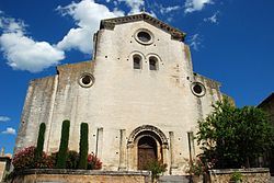
The first parish church of Saint-Germain was replaced in the 13th century by a new building, which underwent several renovations. The Church of Saint-Pierre was completed in 1349 and became the parish church in 1475. The cathedral chapter was established in 1377. Several religious orders were active in the city, including the Jesuits who built their college in 1591. In addition to the Jesuits other orders included the Ursulines (1619), the Sisters of the Annonciade (permanently established in 1646) and the Capuchins (1663).

The first uprising against the Bishop’s power was under the Comité de la Commune de Porrentruy on 20 August 1790, but they were unable to expel the Bishop. However, on 27 April 1792, French Revolutionary troops invaded the city and drove the Bishop out. Porrentruy became the capital of a dependent republic, which was then incorporated into France in 1793 as the Département du Mont Terrible. In 1800, this department was incorporated into the Département du Haut-Rhin as a sub-département. During the War of the Sixth Coalition against Napoleon, Allied troops entered Porrentruy on 24 December 1813. Following their liberation, the future of this former episcopal seat was uncertain. The government divided into two parties, the Episcopal party that sought the return of the prince bishop as the head of a Swiss canton, while the French party wanted to retain the current secular government. However, soon after the fall of Napoleon, the municipality was given to the Canton of Bern (in 1815) to compensate for the loss of the Canton of Vaud, which had become a separate canton in 1803.

Both factions, the religious and the secular, retained power in the town in the following years. The political life in 19th century was characterized by the severe conflict between Liberal-Radicals and the Catholic Conservatives. The secular side gained power in 1860, when the mayor, Joseph Trouillat, was forced out of office. The Radicals retained the mayor’s office and a majority of the town council from 1860 until 1972.

Click on images to enlarge
Le Tour de France 2012: Stage 7

The Tour de France 2012, the world’s premier cycling event kicked off last Saturday with the Prologue in Liège, Belgium and will conclude on July 22 with the traditional ride into Paris and laps up and down the Champs-Élysées. Over the next 22 days the race will take its course briefly along the Northwestern coast of France through  Boulogne-sur-Mer, Abbeville and into Rouen then into the mountains of the Jura, Swiss Alps and the Pyrenees.

We will be Live Blogging Le Tour 2012 every morning at The Stars Hollow Gazette starting at 7:30 AM EDT. Come join us for a morning chat, cheer the riders and watch some of the most beautiful and historic countryside in Europe.

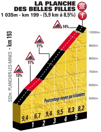
Stage 7 – Tomblaine – La Planche des Belles Filles.  199 km

Stage 7 start and finish were two new locales for Le Tour, the village of Tomblaine and a ski station on the last summit of the Vosges, La Planche des Belles Filles. The riders left the plains and began the rigorous part of the race into the mountains. The mountains in this stage are considered “medium” but the last leg to the summit finish is a category 1 mountain with the last 850 meter at a leg muscle screaming incline of 14%.

Today’s stage start and finish are two new locales for Le Tour, the village of Tomblaine and a ski station on the last summit of the Vosges, La Planche des Belles Filles.

Photobucket

Tomblaine

• Stage town for the first time

• 8,000 inhabitants

• Head of the canton of Meurthe-et-Moselle

A new town on the Tour de France’s map, Tomblaine is situated in the sphere of influence of Nancy, where the peloton has been going since 1905. Fausto Coppi, Louison Bobet and Bernard Hinaul have been winners there, but the memory which is the freshest in our minds is that of Christophe Mengin’s bitter disappointment in the 2005 Tour. The stage’s regional rider had every opportunity to win, by joining the breakaway of the day, and then leaving his fellow riders behind him in the final stretch. The several second’s lead that he still had after the red pennant should have been enough, but he was caught out by the rain and the rider from Lorraine finished his route by crashing into the barriers on the edge of the last bend. Italy’s Lorenzo Bernucci took advantage of his bad luck.

La Planche des Belles Filles

• Stage site for the first time

• The summit of the Vosges massive (1148 m) in Haute-Saône

The only ski resort in the department of Haute-Saône and the last summit of the Vosges, La Planche des Belles Filles (English: Board of the pretty girls) is going to make a promising entrance among the Tour de France’s finish sites. Although the final slope seems to be reserved for the strongest climbers, this place takes its name from a collective and hopeless flight of the women of the valley, who wanted to escape from a massacre declared by the Vikings during their conquest in the 15 th century. The station’s name, according to legend, dates to 1635 when a Swedish soldier engraved an epitaph to some local girls who drowned whilst fleeing him and his men.

Le Tour de France 2012: Stage 6

The Tour de France 2012, the world’s premier cycling event kicked off last Saturday with the Prologue in Liège, Belgium and will conclude on July 22 with the traditional ride into Paris and laps up and down the Champs-Élysées. Over the next 22 days the race will take its course briefly along the Northwestern coast of France through  Boulogne-sur-Mer, Abbeville and into Rouen then into the mountains of the Jura, Swiss Alps and the Pyrenees.

We will be Live Blogging Le Tour 2012 every morning at The Stars Hollow Gazette starting at 7:30 AM EDT. Come join us for a morning chat, cheer the riders and watch some of the most beautiful and historic countryside in Europe.

Stage 6 – Épernay – Metz 207.5 km

The last time a Tour de France stage started in Épernay, home to the leading Champagne houses, was in 2010 and it was HTC-Columbia that were cracking open the bubbly that evening to celebrate yet another stage win by Mark Cavendish. This is another stage that looks nailed-on for a bunch sprint finish.

Épernay is a commune in the Marne department in northern France, located some 130 km north-east of Paris. The town sits on the left bank of the Marne at the extremity of the Cubry valley which crosses it. Épernay is best known as the principal “entrepôt” for champagne wines, which are bottled and kept in large cellars built into the chalk rock on which the town is built. The production of the equipment and raw materials used in the champagne industry is a major source of local employment.

The most famous street in Épernay is the Avenue de Champagne which features the leading Champagne manufacturers.  Its name derives from the presence of many leading champagne producers such as Moët et Chandon, Mercier and De Castellane. Residents say that this avenue is the most expensive in the world, more so than the Champs-Élysées in Paris, because of the millions of bottles of champagne stored in the kilometres of chalk cellars beneath it.

Épernay is the home of  Moët et Chandon which was founded in 1743 by Épernay wine trader Claude Moët who began shipping his wine from Champagne to Paris. The reign of King Louis XV coincided with increased demand for sparkling wine. Moët began business in 1750 with Madame de Pompadour, who supplied the Royal Court at Compiègne with Moët’s champagne. Also in 1750, Moët began establishing business in Germany, Spain, Eastern Europe, and colonial British America. In 1792, on Claude Moët’s death, grandson Jean-Rémy Moët assumed control of Moët et Cie, and expanded the business buying the vineyards of the Abbey of Hautvillers, where Benedictine monk Dom Pérignon perfected double-fermentation for creating champagne.

Metz, the capital of Lorraine, has witnessed 40 stage finishes since it first welcomed the Tour more than a century ago, the most recent being in 1999 when Lance Armstrong won an individual time trial here on his way to the first of his seven consecutive victories in the race. This close to the German border there should be a lot of German fans in evidence, but with Kittel out and Greipel coming in to this stage having already achieved back to back stage wins on stages 4 and 5 it’s unlikely that they will see that ultra rarity – a Tour treble… but you never know, the last one was achieved by Lance Armstrong and included an individual time trial. Super Mario Cipolinni went one better in 1999 winning four in a row with none of the time trials included.

Metz is a city in the northeast of France located at the confluence of the Moselle and the Seille rivers. Metz is the capital of the Lorraine region and prefecture of the Moselle department. Located near the tripoint along the junction of France, Germany, and Luxembourg, Metz forms a central place of the European Greater Region and of the SaarLorLux Euroregion.

A Celtic oppidum, an important Gallo-Roman city, the Merovingian capital of the Austrasia kingdom, the birthplace of the Carolingian dynasty, a cradle of the Gregorian chant, and one of the oldest republics of the common era in Europe, Metz has a rich 3,000-year-history. The city has been steeped in Romance culture, but has been strongly influenced by Germanic culture due to its location and history.

Metz possesses one of the largest Urban Conservation Area in France and more than 100 buildings of the city are classified on the Monument Historique list. Because of its historical and cultural background, Metz benefits from its designation as French Town of Art and History. The city features noteworthy buildings such as the Gothic Saint-Stephen Cathedral, the Basilica of Saint-Pierre-aux-Nonnains, its Station Palace, or its Opera House, the oldest one working in France. Metz is home to some notable venues including the Arsenal Concert Hall and the Centre Pompidou-Metz Museum.

A basin of urban ecology, Metz gained its nickname of Green City, displaying extensive open grounds and public gardens and the historic downtown is one of the largest commercial, pedestrian areas in France.

A historic Garrison town, Metz is the economic heart of the Lorraine region, being specialized in information technology and automotive industries. Metz is home to the University of Lorraine and a centre for applied research and development in the materials sector notably in metallurgy and metallography, the heritage of the Lorraine region’s past in the iron and steel industry.

Le Tour de France 2012: Stage 5

The Tour de France 2012, the world’s premier cycling event kicked off last Saturday with the Prologue in Liège, Belgium and will conclude on July 22 with the traditional ride into Paris and laps up and down the Champs-Élysées. Over the next 22 days the race will take its course briefly along the Northwestern coast of France through  Boulogne-sur-Mer, Abbeville and into Rouen then into the mountains of the Jura, Swiss Alps and the Pyrenees.

We will be Live Blogging Le Tour 2012 every morning at The Stars Hollow Gazette starting at 7:30 AM EDT. Come join us for a morning chat, cheer the riders and watch some of the most beautiful and historic countryside in Europe.

Stage 5 – Rouen – Saint-Quentin 196.5 km

Photobucket

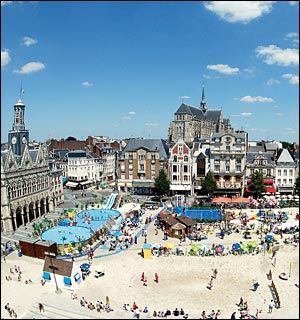
La Plage de l’Hôtel de Ville

Stage 5 began where it ended in Stage 4, Rouen and continued over mostly flat terrain for 196.5 km to Saint-Quentin, a commune in the Aisne department in Picardy in northern France. It is named after Saint Quentin, who is said to have been martyred here in the 3rd century.

History

The city was founded by the Romans, in the Augustean period, to replace the oppidum of Vermand (11 km away) as the capital of Viromandui (Celtic Belgian people who occupied the region). It received the name of Augusta Viromanduorum, Augusta of the Viromandui, in honor of the Emperor Augustus. The site is that of a ford across the River Somme. During the late Roman period, it is possible that the civitas capital was transferred back to Vermand (whose name comes from Veromandis); almost nothing relating to the 4th century has been found in Saint-Quentin.

During the early Middle Ages, a major monastery developed, based on pilgrimage to the tomb of Quentin, a Roman Christian who came to evangelize the region and was martyred in Augusta, giving rise to a new town which was named after him.

From the 9th century, Saint-Quentin was the capital of Vermandois County. From the 10th century, the counts of Vermandois (descendants of the Carolingian, then Capetian families) were very powerful. The city grew rapidly: the “bourgeois” organized themselves and obtained, in the second half of the 11th century (a very early date), a municipal charter which guaranteed their commune a large degree of autonomy.

At the beginning of the 13th century, Saint-Quentin entered the royal domain. At that time, it was a thriving city, based on its wool textile industry (city “drapante”). It was also a centre of commerce boosted by its position on the border of the kingdom of France, between the Champagne fairs and the cities of Flanders (wine exportation, etc.): it had an important annual fair. It also benefited from its location in the heart of a rich agricultural region (trade of grain and “guède”, woad, a high-value blue colouring pigment). to have been martyred here in the 3rd century. [..]

The First World War hit St Quentin very hard. In September 1914, the city was over-run, and it endured a harsh occupation. From 1916, it lay at the heart of the war zone, because the Germans had integrated it into the Hindenburg Line. After the evacuation of the population in March, the town was systematically looted and industrial equipment removed or destroyed. The fighting destroyed it: 80% of buildings (including the Basilica) were damaged.

Despite national support, the reconstruction process was long, and the city struggled to regain its pre-1914 dynamism. The 1911 population of 55,000 was achieved again only in the mid-1950s, in the context of general economic expansion. This prosperity continued until mid-1970s, when the French textile industry began to suffer through competition from developing countries.

Le Tour de France 2012: Stage 4

The Tour de France 2012, the world’s premier cycling event kicked off last Saturday with the Prologue in Liège, Belgium and will conclude on July 22 with the traditional ride into Paris and laps up and down the Champs-Élysées. Over the next 22 days the race will take its course briefly along the Northwestern coast of France through  Boulogne-sur-Mer, Abbeville and into Rouen then into the mountains of the Jura, Swiss Alps and the Pyrenees.

We will be Live Blogging Le Tour 2012 every morning at The Stars Hollow Gazette starting at 7:30 AM EDT. Come join us for a morning chat, cheer the riders and watch some of the most beautiful and historic countryside in Europe.

Abbeville – Rouen 214.5 km

Stage 4 starts in Abbeville located on the Somme River, 20 km (12 mi) from its modern mouth in the English Channel, and 45 km (28 mi) northwest of Amiens

History

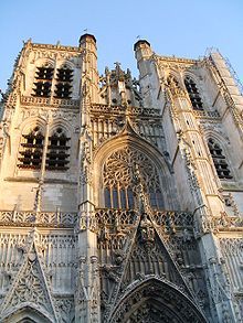
St. Vulfran Collegiate Church,  AbbevilleAbbeville first appears in history during the ninth century. At that time belonging to the abbey of Saint-Riquier, it was afterwards governed by the Counts of Ponthieu. Together with that county, it came into the possession of the Alençon and other French families, and afterwards into that of the House of Castile, from whom by marriage it fell in 1272 to King Edward I of England. French and English were its masters by turns till 1435 when, by the treaty of Arras, it was ceded to the Duke of Burgundy. In 1477 it was annexed by King Louis XI of France, and was held by two illegitimate branches of the royal family in the 16th and 17th centuries, being in 1696 reunited to the crown. In 1514, the town saw the marriage of Louis XII of France to Mary Tudor, the daughter of Henry VII of England.
Abbeville was fairly important in the 18th century, when the Van Robais Royal Manufacture (one of the first major factories in France) brought great prosperity (but some class controversy) to the town. Voltaire, among others, wrote about it. He also wrote about a major incident of intolerance in which a young impoverished lord, the Chevalier de la Barre, was executed there for impiety (supposedly because he did not salute a procession for Corpus Christi, though the story is far more complex than that and revolves around a mutilated cross.)

Abbeville was the birthplace of Rear Admiral Amédée Courbet (1827-85), whose victories on land and at sea made him a national hero during the Sino-French War (August 1884 to April 1885). Courbet died in June 1885, shortly after the end of the war, at Makung in the Pescadores Islands, and his body was brought back to France and buried in Abbeville on 1 September 1885 after a state funeral at Les Invalides a few days earlier. Abbeville’s old Haymarket Square (Place du Marché-au-Blé) was renamed Place de l’Amiral Courbet in July 1885, shortly after the news of Courbet’s death reached France, and an extravagant baroque statue of Courbet was erected in the middle of the square at the end of the nineteenth century. The statue was damaged in a devastating German

The route follow through the villages hugging the coastline until it takes a left turn inland at Fécamp home of the Fécamp Abbey where Bénédictine, a herbal liqueur beverage, was developed by Alexandre Le Grand in the 19th century. It is claimed that at the Benedictine Abbey of Fécamp in Normandy, monks had developed a medicinal aromatic herbal beverage which was produced until the abbey’s devastation during the French Revolution, but in fact Alexandre Le Grand invented the recipe himself, helped by a local chemist, and he told this story to connect the liqueur with the city history and to sell his liqueur the best as possible. And so goes the way of a myth.

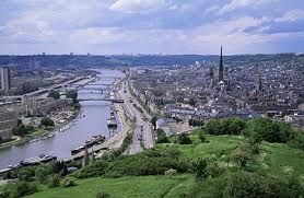
Rouen, Fr Then it is on the the finish in the historic capital city of Normandy, Rouen, located on the river Seine. Once one of the largest and most prosperous cities of medieval Europe], it was the seat of the Exchequer of Normandy in the Middle Ages. It was one of the capitals of the Anglo-Norman dynasties, which ruled both England and large parts of modern France from the 11th to the 15th centuries. It was here that Joan of Arc was executed in 1431. People from Rouen are called Rouennais.

Main Sights

Rouen is known for its Notre Dame cathedral, with its Tour de Beurre (butter tower). The cathedral was the subject of a series of paintings by Claude Monet, some of which are exhibited in the Musée d’Orsay in Paris. It contains a tomb of Richard the Lionheart which contained his heart. His bowels were probably buried within the church of the Chateau of Châlus-Chabrol in the Limousin. It was from the walls of the Chateau of Châlus-Chabrol that the crossbow bolt was fired, which led to his death once the wound became septic. His corporeal remains were buried next to his father at Fontevraud Abbey near Chinon and Saumur, France. Richard’s effigy is on top of the tomb, and his name is inscribed in Latin on the side.
The Cathedral also contains the tomb of Rollo (Hrólfr, Rou(f) or Robert), one of Richard’s ancestors, the founder and first ruler of the Viking principality in what soon became known as Normandy.

The cathedral contained the black marble tomb of John Plantagenet or John Lancaster, Duke of Bedford, who is considered to be Joan of Arc’s murderer. He became a canon priest of the cathedral after her death. His original tomb was destroyed by the calvinists in the 16th century but there remains a commemorative plaque .

The Gros Horloge is an astronomical clock dating back to the 16th century, though the movement is considerably older (1389). It is located in the Gros Horloge street.

Other famous structures include the Gothic Church of St Maclou (15th century); the Tour Jeanne d’Arc, where Joan of Arc was brought in 1431 to be threatened with torture (contrary to popular belief, she was not imprisoned there); the Church of Saint Ouen (12th-15th century); the Palais de Justice, which was once the seat of the Parlement (French court of law) of Normandy and the Museum of Fine Arts and Ceramics which contains a splendid collection of faïence and porcelain for which Rouen was renowned during the 16th to 18th centuries.

Rouen is noted for its surviving half-timbered buildings.

There are many museums in Rouen: Musée des Beaux-Arts de Rouen, an art museum with pictures of well-known painters such as Claude Monet and Géricault; Musée maritime fluvial et portuaire, a museum on the history of the port of Rouen and navigation; Musée des antiquités, an art and history museum with antic or gothic works; Musée de la céramique, Musée Le Secq des Tournelles…

The Jardin des Plantes de Rouen is a notable botanical garden dating to 1840 in its present form. It was previously owned by Scottish banker John Law and was the site of several historic balloon ascents.

In the centre of the Place du Vieux Marché (the site of Joan Of Arc’s pyre) is the modern church of Saint Joan of Arc. This is a large, modern structure which dominates the square. The form of the building represents an upturned viking boat and fish shape.

Rouen was also home to the French Grand Prix, hosting the race at the nearby Rouen-Les-Essarts track sporadically between 1952 and 1968. There was a campaign in 1999 by Rouen authorities to obliterate remainders of Rouen’s racing past. Today, little remains beyond the public roads that formed the circuit.

Le Tour de France 2012: Stage 3

The Tour de France 2012, the world’s premier cycling event kicked off last Saturday with the Prologue in Liège, Belgium and will conclude on July 22 with the traditional ride into Paris and laps up and down the Champs-Élysées. Over the next 22 days the race will take its course briefly along the Northwestern coast of France through  Boulogne-sur-Mer, Abbeville and into Rouen then into the mountains of the Jura, Swiss Alps and the Pyrenees.

We will be Live Blogging Le Tour 2012 every morning at The Stars Hollow Gazette starting at 7:30 AM EDT. Come join us for a morning chat, cheer the riders and watch some of the most beautiful and historic countryside in Europe.

Orchies, Fr  Musée de la chicoréeStage 3 on Tuesday started in Orchies, a commune in northern France. It is the world capital of chicory and especially known for its Musée de la chicorée, the museum of chicory.

• Stage town on one previous occasion

• 8,500 inhabitants

• Head of the canton of Nord

The riders will appear for the first time in France in Orchies, which submitted a joint candidacy with Tournai as a Euroregion, a unique happening on the Tour. But Orchies is also one of the rare towns that is a stage that does not have a winner! In 1982, only three teams had set off when the team time-trial was interrupted in Denain by strike action, as a protest against the closure of the Usinor Group. On the other hand, last year, the town may have witnessed the birth of a future great champion, with the victory of Germany’s Marcel Kittel in the 1st stage of the Four Days of Dunkirk.

Many of the streets are cobblestone but Le Tour will be avoiding them. The riders will travel 197 km over a moderately hilly route with an up hill finish in Boulogne-sur-Mer:

Although the two last stages of the Tour which ended in Boulogne-sur-Mer were sprint finishes, with the victories of the Dutch Jean-Paul Van Poppel in 1994, and of the German Erik Zabel in 2001, the profile of the third stage is ideal for initiatives like those which allowed Pierrick Fédrigo and Sylvain Chavanel to obtain the French Champion’s jersey. In 2005, the air of the town greatly inspired Fédrigo, who also won the Four Days of Dunkirk’s pink leader jersey a few weeks earlier.

Originally named Gesoriacum and probably also to be identified with Portus Itius, by the 4th century Boulogne was known to the Romans as Bononia and served as the major port connecting the rest of the empire to Britain. The emperor Claudius used this town as his base for the Roman invasion of Britain, in AD 43, and until 296 it was the base of the Classis Britannica.[citation needed] Zosimus called the city “germanorum”, Germanic speaking, at the end of the 4th century. The city was an important town of the Morini.

In the Middle Ages it was the centre of a namesake county. The area was fought over by the French and the English and Boulogne was occupied by the English from 1544 to 1550. In 1550, The Peace of Boulogne ended the war of England with Scotland and France. France bought back Boulogne for 400,000 crowns.  

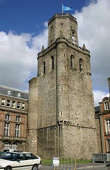
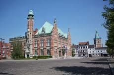
Belfry Boulogne-sur-MerIn the 19th century the Cathedral of Notre-Dame was reconstructed by the priest Benoit Haffreingue after he received a call from God to reconstruct the town’s ruined basilica. During the Napoleonic Wars, Napoleon amassed La Grande Armée in Boulogne to invade the United Kingdom in 1805. However, his plans were halted by other European matters and the supremacy of the Royal Navy (including thousands of Congreve rockets)
On 22 May 1940 during the Battle of France, two British Guards battalions and some pioneers attempted to defend Bolougne against an attack by the German 2nd Panzer Division. Despite fierce fighting, the British were overwhelmed and the survivors were evacuated by Royal Navy destroyers while under direct German gunfire.[4] On June 15, 1944, 297 planes (155 Avro Lancasters, 130 Handley Page Halifaxes, and 12 De Havilland Mosquitos) of the Royal Air Force bombed Boulogne harbour to suppress German naval activity following D-Day. Some of the Lancasters carried Tallboy bombs, and as a result, the harbour and the surrounding area were completely destroyed. In August, 1944 the town was declared a “fortress” by Adolf Hitler, but it succumbed to assault and liberation by the 3rd Canadian Division in September. In one incident, a French civilian guided the Canadians to a “secret passage” leading into the walled old town and by-passing the German defenders.

To replace the destroyed urban infrastructure, affordable housing and public facility projects in functional, brutalist building styles were carried out in the 1950s and 60s. The harbour therefore sometimes proves to be a disappointment to tourists looking for a typical northern French harbour scene.

Main sights

* Belfry (11th century), part of the UNESCO Heritage Sites List.

* Medieval castle, whose foundations date to Roman times. It houses an Egyptian art collection

* Gothic church of St. Nicholas, housing several 15th century statues

* Cathedral basilica of Notre-Dame, with a dome standing at over 100 m. The crypt is one of the largest in France, and has Roman, Romanesque and Gothic elements.

* Opened in 1991, Nausicaä – The French National Sea Centre is a science centre entirely dedicated to the relationship between mankind and the sea. It houses Aquaria, exhibitions on the marine fauna, and the exploitation and management of marine resources (fisheries, aquaculture, coastal planning, maritime transport, exploitation of energies and mineral, tourism).

* The Boulogne Eastern Cemetery, created during the Great War

There is a very unique exhibit in front of the Boulogne-sur-mer’s city hall, “The Car Versus Nature

   The result is more garden than graveyard for such auto parts as rearview mirrors, tires, steering wheels and entire bench seats planted among the shrubbery. The group says it’s intended to show that “against the creations of Man, Nature always wins in the end.” Nature is definitely making herself known in the plants growing through the tops of such vehicles as a Citroën 2CV. Walkways are lined with tire treads, leather car seats invite passers-by to stop and have a seat, and gearboxes sit at the main entrances to the display area. In all, six cars, two bicycles, one motorbike and a tractor are “planted” in the installation, along with an uncounted number of vehicle components and accessories.”

Car Versus Nature Boulogne-sur-mer

Click on image to enlarge for the article, a slide show and a video.

Le Tour de France 2012

The Tour de France 2012, the world’s premier cycling event kicked off last Saturday with the Prologue in Liège, Belgium and will conclude on July 22 with the traditional ride into Paris and laps up and down the Champs-Élysées. Over the next 22 days the race will take its course briefly along the Northwestern coast of France through  Boulogne-sur-Mer, Abbeville and into Rouen then into the mountains of the Jura, Swiss Alps and the Pyrenees.

Route Le Tour 2012

Click on image to enlarge.

We will be Live Blogging Le Tour 2012 every morning at The Stars Hollow Gazette starting at 7:30 AM EDT. Come join us for a morning chat, cheer the riders and watch some of the most beautiful and historic countryside in Europe.  

Load more